
|
HEAT LEVELS CONTINUE TO STAY THE SAME - We are forecasting a high in the 93-97 degree range for much of the North Texas region this evening, very similar to the past few days. Sunshine will remain in full force, and while there could be a couple of showers and thunderstorms on the radar, they will be "few and far between". The chance of one spot getting wet is only in the ten to twenty percent bracket. THE WEEKEND - Tomorrow will be the same as recent days; fair nights, hot, humid, and breezy afternoons, highs in the low to mid 90s, which is only a few degrees above the average high for early June. The sky will feature more sun than clouds. NEXT WEEK - Not much change. A routine June weather pattern will stick with us through most of next week; hot and breezy afternoons, comfortable nights with highs in the mid 90s and lows in the mid to upper 70s. In terms of the model madness concerning next week's potential tropical situation in the Gulf, the GFS continues to show the potential for a tropical low of some sort to form somewhere near the Caribbean and the Gulf during the latter half of next week. The 06Z run takes that same system or tropical low to Central Florida by Monday morning. Meanwhile, the European model consistently shows absolutely no activity in the Gulf or the Caribbean. As always, we will side with the European model solution and continue to ignore the GFS at this present time. See the Texas Weather Discussion Video for more details. 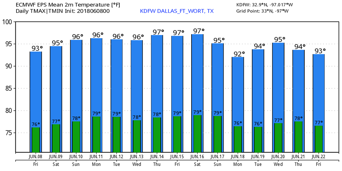 TROPICS - The Atlantic Basin continues to remain quiet. Meanwhile, Hurricane Aletta reached Category Four strength this morning over the Eastern Pacific. It is moving westward, and poses no threat to land. 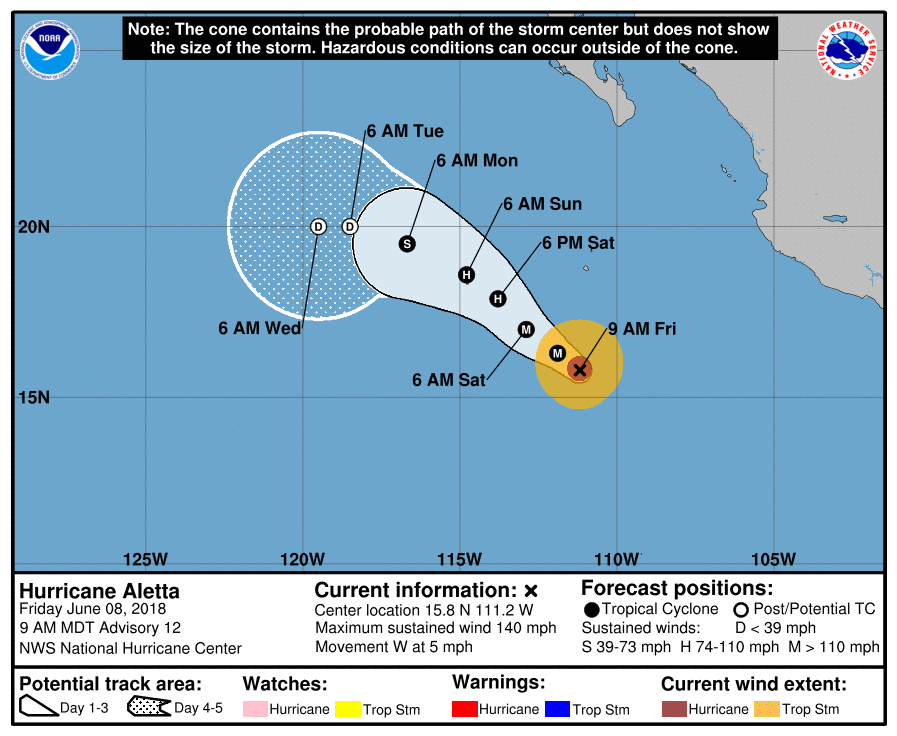 |
Archives
March 2023
Categories |
 RSS Feed
