
|
Today was another record setting day, with an official high of 109° around 4pm. But this record high trend is going away, as a cold front is likely to move through the area tomorrow. Highs will still reach 100° or so, but not nearly as miserable! A few hit or miss storms could develop behind the front, but subsidence from the lingering high pressure should keep storms at a minimum. However, IF any storms even develop, they could produce damaging wind gusts and very heavy rainfall. Only 10-20% of us will see any rainfall. Typical... Heading through the rest of the week, we will remain dry with highs in the upper 90s to lower 100s. But, it won’t be nearly as miserable as the past few days, just a more “tolerable” hot type of conditions. Stay hydrated! We are starting to raise thunderstorm chances for Sunday into next Monday as a cold front is expected to encroach the region. This will enhance storm chances and may give us our best chance of rain we’ve had in a while!  As we are still in the summertime, it’s getting to that point of year where we begin to think about the upcoming fall and winter as we are getting closer and closer to the start of meteorological fall on September 1st, which is only 40 days from now! Also, Christmas is only 156 days away! ;) This winter looks to be a polar opposite of some of our past winters as we may have a colder pattern. (Haha, get it??) The type of pattern we will (likely) have this winter is a moderate El Niño Modoki. This tends to bring the storm track south and colder air much farther south.  This pattern tends to bring much colder air to the state of Texas.  We will continue to keep an eye on this, as we are LONG overdue on a major winter storm. I am NOT going to guarantee anything, but the odds of colder and wetter weather are greater this year than the past few years. (2015-16, 2016-17, 2017-18 Winters) These last few years where we have lacked snow and cold air have been La Niña winters and have not been in the favor of winter storm lovers. The La Niña has kept the storm track to the north and the cold air locked in the NE CONUS. Here’s a graphic explaining the pattern differences between La Niña and El Niño. 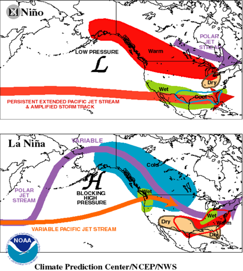 The exact definition of an El Niño Modoki is El Niño Modoki is a coupled ocean-atmosphere phenomenon in the trop. Pacific. It is different from another coupled phenomenon in the Pacific, a typical El Niño. El Niño is characterized by strong anomalous warming in the eastern equatorial Pacific, as this will apply to this upcoming winter. (should the pattern favor a Modoki)
We will watch this, and we hope you have a fantastic week! The Texas Weather Discussion Video will he uploaded tomorrow! Jonathan Williams |
Archives
March 2023
Categories |
 RSS Feed
