
|
RADAR CHECK: We have isolated showers and thunderstorms about to the east of the metroplex as humidity levels continue to increase over time. The sky is mostly sunny, and temperatures are around the low 90s across North Texas. The average high for DFW Airport for June 16 is 92°. 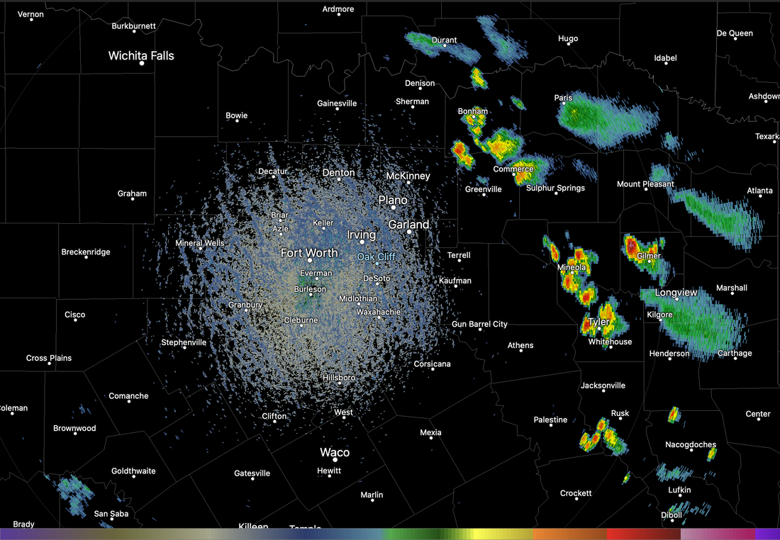 Those thunderstorms should dissipate during the overnight hours, and tonight will be mostly fair with lows in the low 70s. Some of the cooler spots will visit the upper 60s again. TOMORROW THROUGH FRIDAY: Look for partly cloudy days and fair nights. A shower or storm could pop up, but they will remain few and far between. Most places will remain dry. Highs will be in the mid 90s for the rest of the workweek. Humidity levels will continue to rise. THE WEEKEND: We expect afternoon highs in the 92-97° range over the weekend with a good supply of sunshine. On Father's Day, we will mention the chance of scattered, mostly afternoon and evening showers and storms. No telling where the storms form and who gets rain. Just know that there is a 1 in 3 chance of getting wet on Sunday. NEXT WEEK: During the beginning of the week, the pattern begins to shift, allowing deeper moisture to make it into the state, increasing the chances of isolated showers and storms for the beginning of the week. Highs will be in the mid 90s, lows in the mid 70s with a mix of sun and clouds each day. 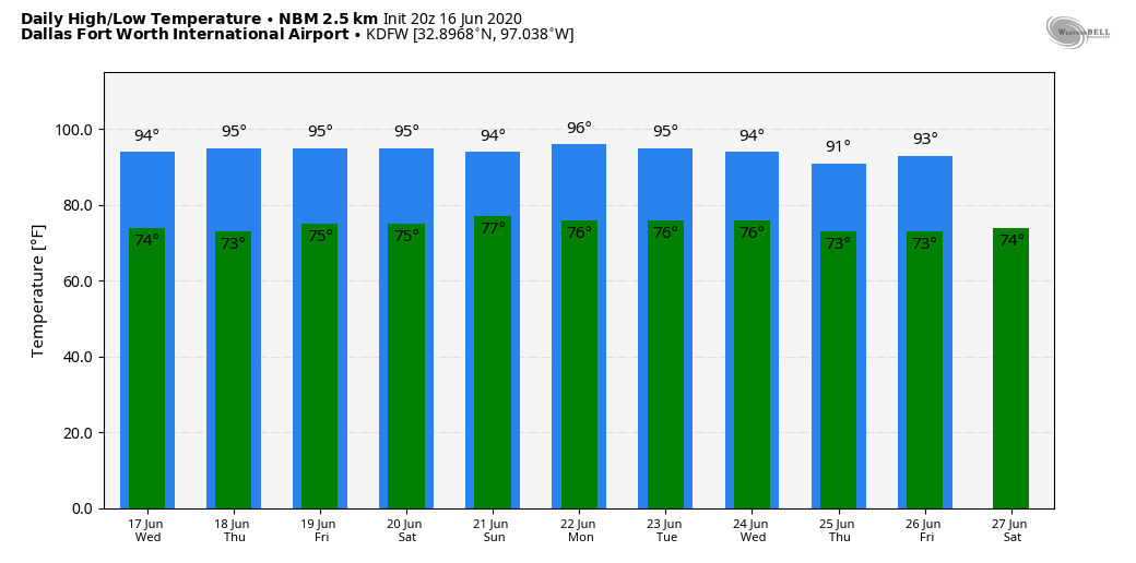 TROPICS: A non-tropical low-pressure area located about 150 miles south-southeast of the North Carolina-South Carolina border continues to produce disorganized showers and thunderstorms over portions of southeastern and eastern North Carolina, including the Outer Banks, and adjacent Atlantic waters. The low has moved little today, but a slow northward motion is forecast to begin by this evening. Environmental conditions are expected to remain unfavorable for significant development through tonight when the low should move inland over eastern North Carolina. Regardless of development, heavy rainfall could occur over portions of northeastern South Carolina and southeastern and eastern North Carolina through tomorrow. The rest of the Atlantic Basin is quiet.
ON THIS DAY IN 2014: a supercell thunderstorm would produce 5 tornadoes, one rated EF-0 and four rated EF-4, across northeastern Nebraska. The town of Pilger was hardest hit when it took a direct strike from one of the EF-4 tornadoes. The third EF-4 tornado, also known as “Pilger East” was likely the strongest tornado of the outbreak, but fortunately remained in rural areas. The most remarkable thing about this outbreak was the “twins”. Tornadoes 2 and 3 (known as Pilger and Pilger East respectively) became two photogenic twins, at times moving around each other, and crossing paths. After tornado 3 dissipated, tornado 4 (Wakefield) and tornado 2 were twins for a short period of time. Look for the next blog update at around the same time tomorrow... Have a great night! Donovan Neal Owner - ApexStorm |
Archives
March 2023
Categories |
 RSS Feed
