
|
RADAR CHECK: As advertised, isolated showers and storms are non-existent across the region this afternoon. The sky is mostly sunny with temperatures in the middle to upper 90s with heat indices well within the triple digits. Temperatures overnight will stay in the upper 70s. TOMORROW THROUGH THE WEEKEND: Unfortunately, tomorrow looks to be the last time with highs in the upper 90s for a few days. Look for a high in the triple digits this weekend as heat levels continue to rise. A Heat Advisory is in effect through Saturday evening, but, I do expect that to get extended. An Excessive Heat Watch may be needed for areas to the south and east of the metroplex. One way or another, it will stay VERY hot across NTX over the forecast period. 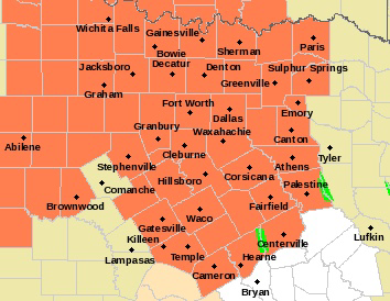 NEXT WEEK: Hot, humid weather is the main headline of weather through the course of next week. Basically, what you would expect around here in July. Highs in the upper 90s to triple digits, mostly sunny skies, and a non-zero chance of an isolated shower or storm during the daytime heating process. TROPICS: Looks like Tropical Storm Fay has formed out of the northern banks of the Carolinas. it will move northeast in coming days, hugging the upper Atlantic coast of the U.S. The system is expected to produce locally heavy rainfall that could cause some flash flooding across portions of eastern North Carolina, the coastal mid-Atlantic, and southern New England during the next few days. Gusty winds are also possible along the North Carolina Outer Banks today, and along the mid-Atlantic and southern New England coasts Friday and Saturday. The rest of the Atlantic basin, including the Gulf of Mexico, is very quiet. ON THIS DAY IN 1979: Hurricane Bob was born in the Gulf of Mexico, becoming the first Atlantic Hurricane to be given a male name. Look for the next Texas Weather Blog update at around noon tomorrow.. Have a great night! Donovan Neal Owner - ApexStorm Double-tap to edit.
|
Archives
March 2023
Categories |
 RSS Feed
