
|
It is already 80 degrees in some spots in North Texas today. In fact, at 5:02 this morning, DFW had a temperature reading of 82. When we start out the day in the 80s, you know it is going to be pretty hot this late afternoon and evening. In fact, a Heat Advisory still remains in effect today through Thursday evening, where heat indices of 105-109 will be possible due to increase dewpoint values. The weather will be consistent for the rest of this week; mostly sunny and hot with highs at or near 100 degrees. Rain chances should stay at a minimum due to the upper level ridge creating a hotter and drier atmosphere. The Weekend - We are in luck! Not only will we see a chance of showers and storms, but we will also see temperatures back off a little more! This is because the upper level high will shift back to the west and will create an environment for moisture to come back. Storms will be possible along a cold front this weekend. We can't be too specific yet, but the chance of any one spot getting wet is in the 20-30 percent bracket. Otherwise, expect mostly cloudy skies with highs in the mid 90s; yes, that is much better than what we are in right now. The Week - It will be even cooler next week! Expect highs in the mid to lower 90s for most of the week in addition to increased rain chances, especially during the latter half of the week. It looks like another cold front will be possible late next week, but too early out to tell. But good news is, no signs of any excessively hot weather, especially during the hottest part of the year. See the Texas Weather Outlook for more details. 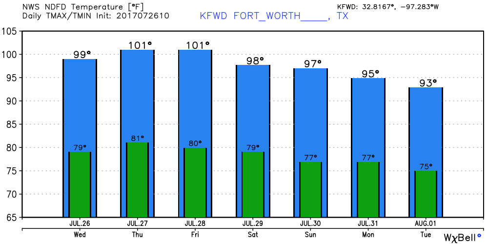 Tropical Talk - There is one weak little wave in the African Coast. Due to the amount of dry air in the Atlantic Basin, I don't think we should worry about it short-term, and in the medium range. 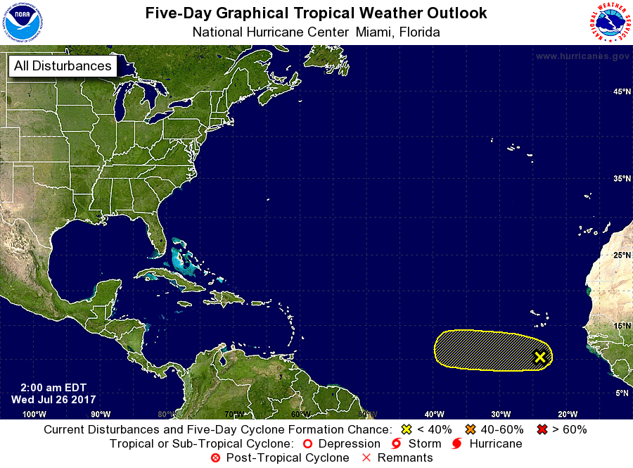 Make it a great day!
Donovan Neal |
Archives
March 2023
Categories |
 RSS Feed
