
|
DFW starts the day in at 71 at 5:38, which is, of course a noticeable change from yesterday. But, most locations are currently in the 60s to start the day. That is a change from recent days, and will continue to stay like that for the next several days. Tomorrow Through the Weekend - A pattern change will be coming. The circulation over the southeast U.S (formally Irma) will lift to the northeast, and an upper ridge will start to build. To the west, a cold, upper trough will develop over the northwest U.S, where some people in Montana and Wyoming are under Winter Storm Warnings. In north Texas, we forecast mostly sunny and hot days with cool nights with very little to no precipitation expected. Highs will stay in the low to mid 90s for the next 9-10 days. Football Weather - The weather looks really good for some high school football today and tomorrow. The temperature should start at or near 91 degrees at kickoff, cooling off at 82-85 degrees by the fourth quarter/near the end of the game. Next Week - The upper air pattern holds. Warm and hot for the south and east U.S. including north Texas, and cold to the northwest. For north Texas, conditions will continue to be dry and hot with highs in the low 90s. See the Texas Weather Discussion Video for more details. 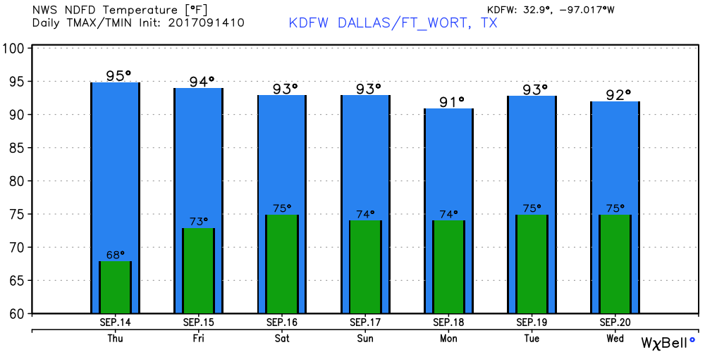 Jose - Jose is still a minimal hurricane with maximum sustained winds of 75 mph. It is in the Atlantic, well to the north of Puerto Rico and the Bahamas. It is expected to make a turn to the north and continue to the northeast as a hurricane. The NHC track keeps the storm well to the east of the U.S. The rest of the Atlantic is quiet. 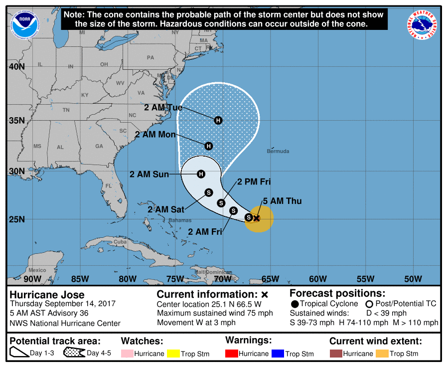 |
Archives
March 2023
Categories |
 RSS Feed
