
|
Today, we are not as hot as we will be later in the week, but still pretty hot. 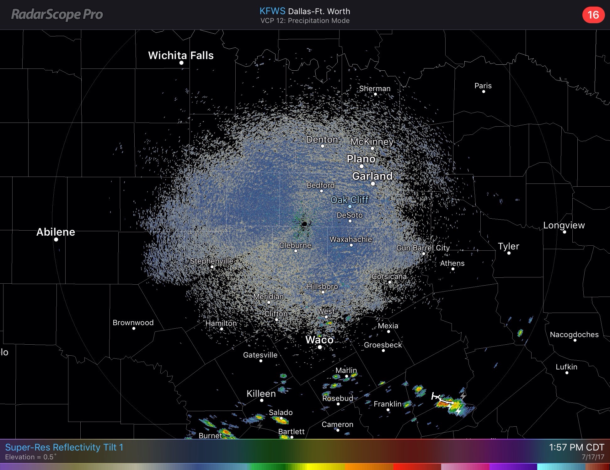 Radar Update - Scattered showers and storms are more likely the farther south past Waco that you go, where the atmosphere is a little more moist and unstable. If anything reaches North Texas, it will most likely be in the form of an isolated shower or two that quickly dissipates. Otherwise, expect mostly sunny skies with highs in the 95-98 range. Rest of the Week - The weather will feel hotter and drier as an upper ridge begins to build in. Tomorrow, if we see anything in terms of precipitation, it will be more spaced, and should dissipate quicker, including anything farther south. Going forward after tomorrow we won't have ANY chances of rain for the next several days. In fact, by Wednesday or Thursday, we will have a good chance of temperatures reaching the century mark (100 degrees). With higher temperatures, comes higher heat index values, which will range from 103-110 during most days of this heat wave, which will be the story for Thursday and out, as the heat 'dome' builds in a large chunk of the US. This Weekend - Not much change in the forecast. Still very sunny with highs likely in the triple digits with no precipitation... Next Week (The start of Summer Band :D) - Models suggest that the ridge starts to weaken, which also means that temperatures will come down a tad, and we will start to see a bit better cloud coverage and slightly better chances of precipitation. Please see the Texas Weather Outlook for more details. 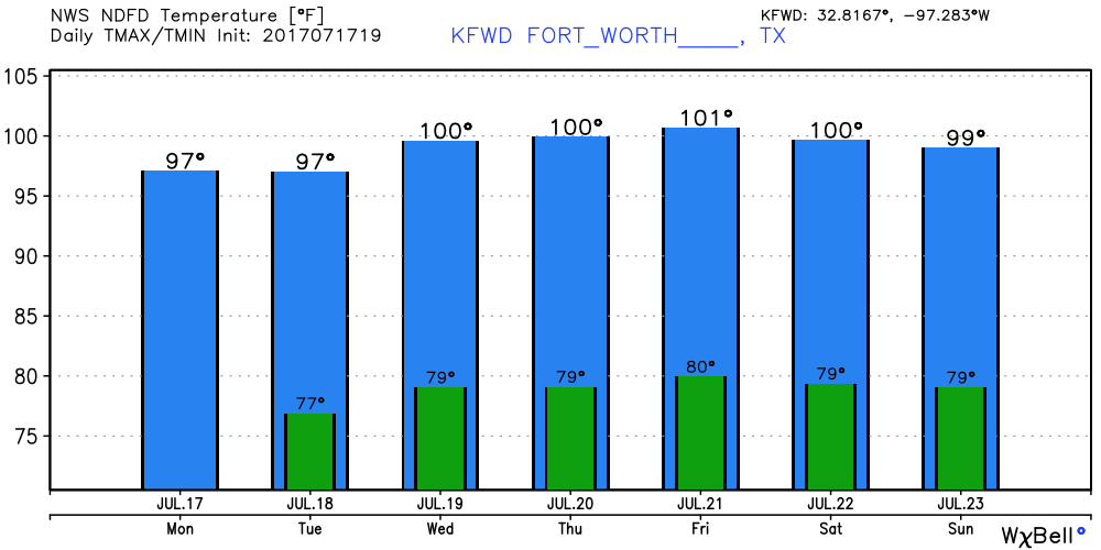 Tropical Talk - Two tropical waves to talk about in the Atlantic. The first one has a "flip a coin" chance of developing, but will remain low in latitude and will not impact the Gulf of Mexico or the US. 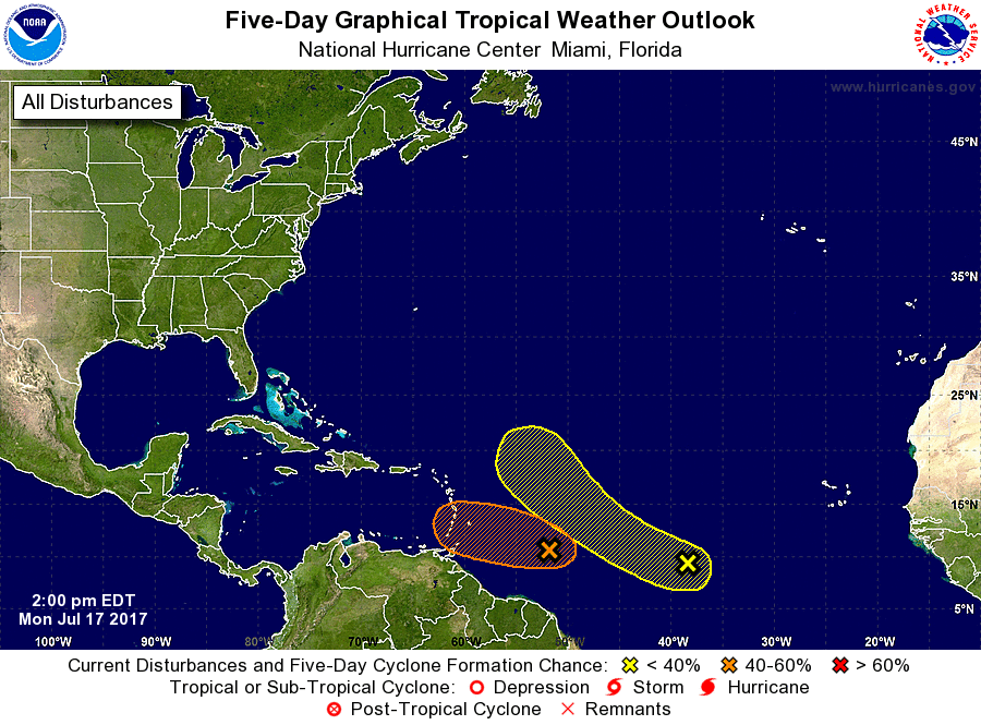 Have a great rest of the day.
Donovan Neal |
Archives
March 2023
Categories |
 RSS Feed
