
|
HOT CONDITIONS CONTINUE - While temperatures are in the middle to upper 80s right now, we are continuing to project highs in the middle 90s later this afternoon and tomorrow as well with mostly sunny skies each day. While the chance of any one spot getting wet is not zero, and isolated shower or storm that happens to form will be few and far between. THE WEEKEND - Not much change for the weekend. We will continue with the typical June weather pattern with mostly sunny skies with hot and humid conditions. Any thunderstorm that happens to develop will be random, mostly during the afternoon and evening hours. Highs for the weekend should be just at or above the 95 degree range. NEXT WEEK - An area of high pressure will continue to build over Central Texas, which puts us in a dry slot for much of next week. Hot and humid days with lots of sunshine are in the forecast. Highs should be in the 92-98 degree range. WILL WE SEE BERRYL?? - The GFS has been consistently showing the progression of a developing high-end tropical storm/low-end hurricane moving north towards Mobile, Alabama Thursday night/early Friday morning of next week. However, the European model shows a big full bag of nothing. Do note that the European model is the most reliable model in these situations, so we will continue to buy that solution and monitor any changes. See the Texas Weather Discussion Video for more details. 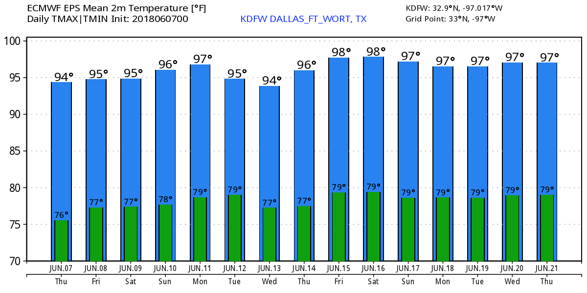 TROPICS - The Atlantic Basin continues to remain quiet over the next week. However, if we look to our left, over in the Eastern Pacific, Tropical Storm Aletta is forecast to become a hurricane later this evening. Maximum sustained winds are already at 70, but it will continue to churn in open water with no threat to land. 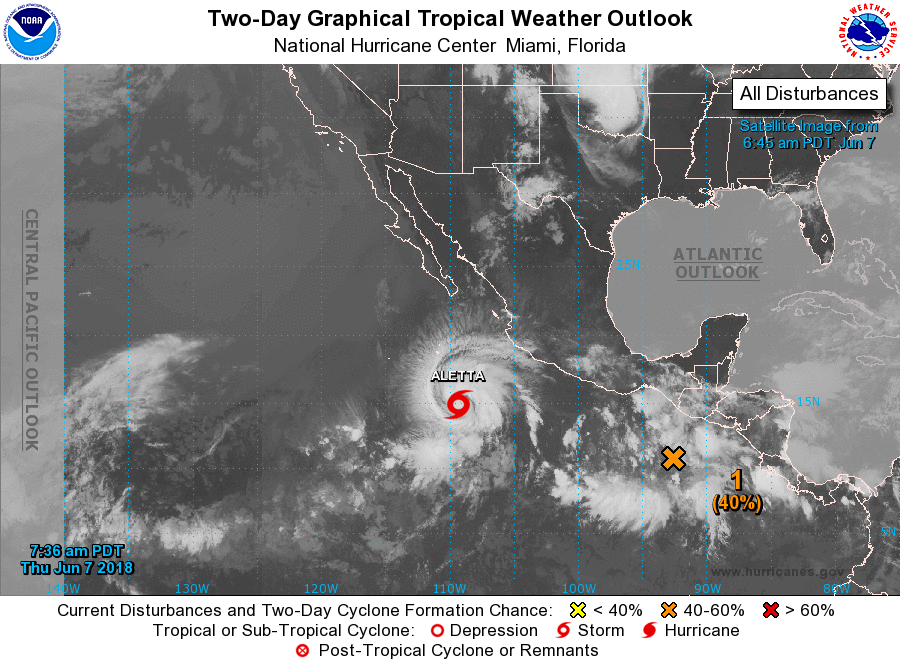 |
Archives
March 2023
Categories |
 RSS Feed
