
|
ANOTHER MILD START - Temperatures are mostly in the mid 70s this morning across the North Texas region. We will continue to be very warm today with afternoon highs in the upper 80s to low 90s. Nothing on the radar for the DFW metro though. TO THE NORTHEAST - A cluster of strong storms over parts of the Texas/Oklahoma border. These storms are moving to the east.  We will continue to mention the chance of random scattered showers and thunderstorms at times during the afternoon and evening. Some of those storms could turn marginally severe with gusty winds and large hail the dominant threat. We do note that the SPC has a "marginal" risk of severe storms defined for parts of North Texas. 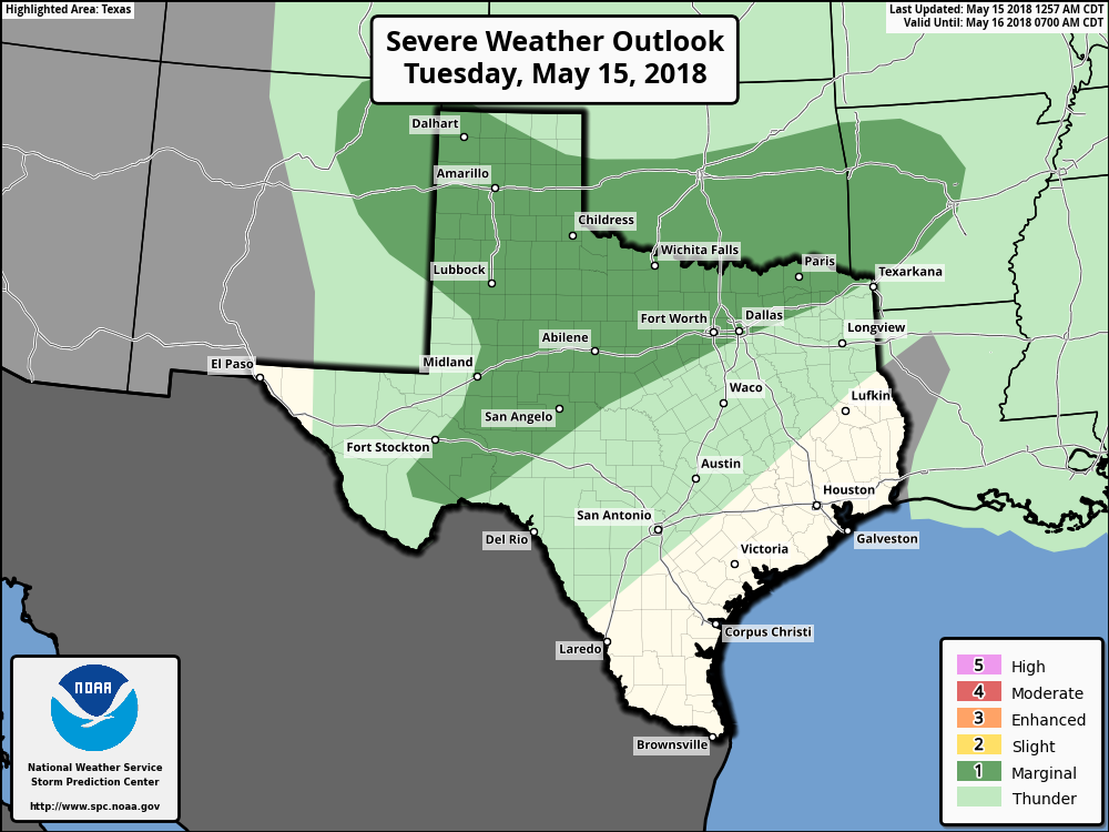 Otherwise, we will forecast partly cloudy skies with highs in the upper 80s. TOMORROW THROUGH FRIDAY - We will mention the chance of a cluster of strong thunderstorms during the pre-dawn hours on Wednesday, before turning dry for the remainder of the week. The sun comes out in full force on Friday, and we should be dry with highs in the low to mid 90s throughout the latter half of the week. THE WEEKEND - Expect another mild weekend ahead with sunshine in full force. Highs will be at around 95 on Saturday, only dropping to about 93 on Sunday. It will be the hottest weekend so far. NEXT WEEK - Moisture from the disturbance in the gulf gets locked inland, and we will mention the chance of scattered showers and thunderstorms as that moisture overspreads the region. Highs will remain in the middle 90s with a mix of sun and clouds. The latter half of next week looks dry. See the Texas Weather Discussion Video for more details. 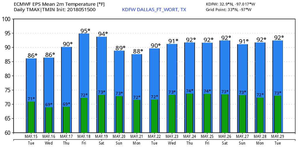 |
Archives
March 2023
Categories |
 RSS Feed
