
|
Radar Update - Showers and storms have developed to the south of Ennis, and are expected to slowly drift off to the southeast. 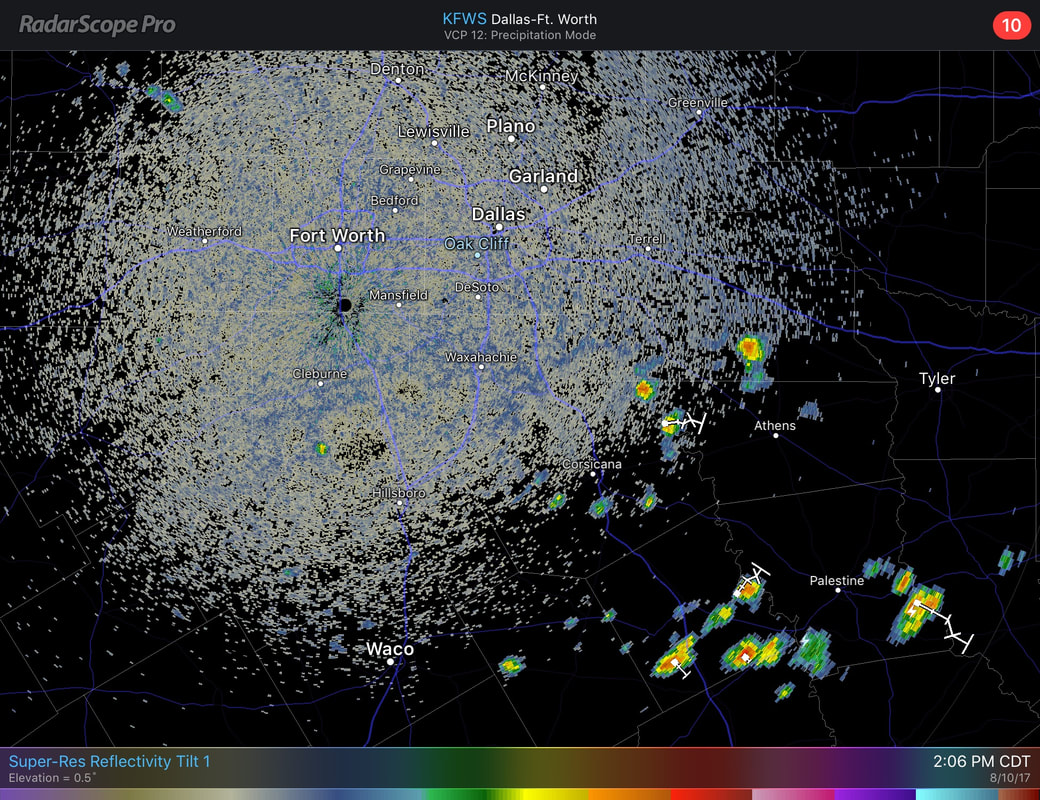 Storms may produce brief heavy rain and some lightning at times, but no severe weather is expected. If any rain, the highest coverage will be to the south and east of DFW. For most of us, we should continue to enjoy sunshine with clouds out at times and highs in the middle to upper 90s. Tomorrow and the Weekend - Not much change when you talk about Friday and Saturday. An upper-level high to the southwest should keep us hot and humid for the next few days with highs in the upper 90s with heat indices in the 100-degree range. By Sunday, a surface front drops from the north which should give us more chances of showers and storms with slightly cooler temperatures, which we will start to notice by Sunday evening. Otherwise, the weekend should be clear with highs in the middle to upper 90s again with plenty of sunshine. Next Week - Monday and Tuesday will be the best chance for showers and storms for a while due to moist air coming from the surface front from the north. I can't be specific about when it could rain, just know that we have a chance both days. We should struggle to get out of the 80s for these days due to the amount of cloud cover and rain. Going forward, we should have drier air and temperatures should warm back up to the middle to upper 90s. See the Texas Weather Outlook Video for more details. 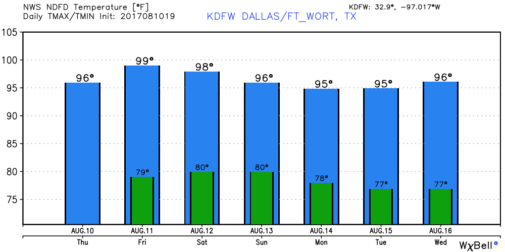 Tropical Talk - Hurricane Franklin dissipated to an open wave as soon as it made landfall for the second time. Invest 99L is still northeast of the Leeward Islands, and some development is possible once it gets into a better environment. If it develops, it is expected to recurve back into the Atlantic Basin, posing no threat to the U.S.. There is one more disturbance near Miami and the Bahamas, expected to produce heavy rain in those areas but is not expected to develop. 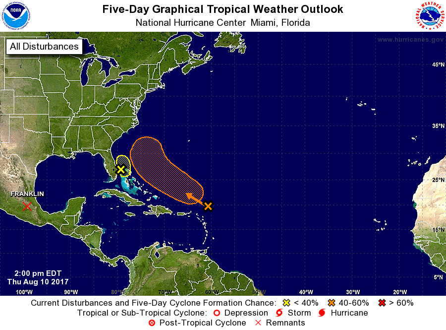 Have a great rest of the day.
|
Archives
March 2023
Categories |
 RSS Feed
