
|
WARM MORNING: Temperatures are generally in the 82-85° across most places in the region this morning with mostly fair skies. We have some good, soaking rain in Oklahoma and around Wichita Falls this morning. It is moving slowly; and will dissipate during the late afternoon/evening. ONE MORE VERY HOT DAY: A "Heat Advisory" remains in effect for all of North Texas today. Temperatures won't be much different from the past couple of days; highs should be in the 100 degree range, but humidity values past 50% could push heat indices to around 110° again this afternoon. The record high for DFW today is 105° set in 1951, which should be safe. The average high for August 13 is 97°. TONIGHT/WEDNESDAY: A surface front will approach tonight, and isolated to scattered showers and storms could invade our northern counties as early as this late afternoon/evening. Then, tomorrow morning, we will have a good chance of scattered showers and storms for a good portion of the region. Understand that we can not promise rain for everyone, but any one spot stands a 40/50 percent chance of getting wet, especially during the pre-dawn hours. We also note that the SPC has a "marginal risk" of severe storms (level 1 of 5) defined for the DFW Metroplex and points to the north; some of the storms could produce wet microbursts and strong, gusty winds. 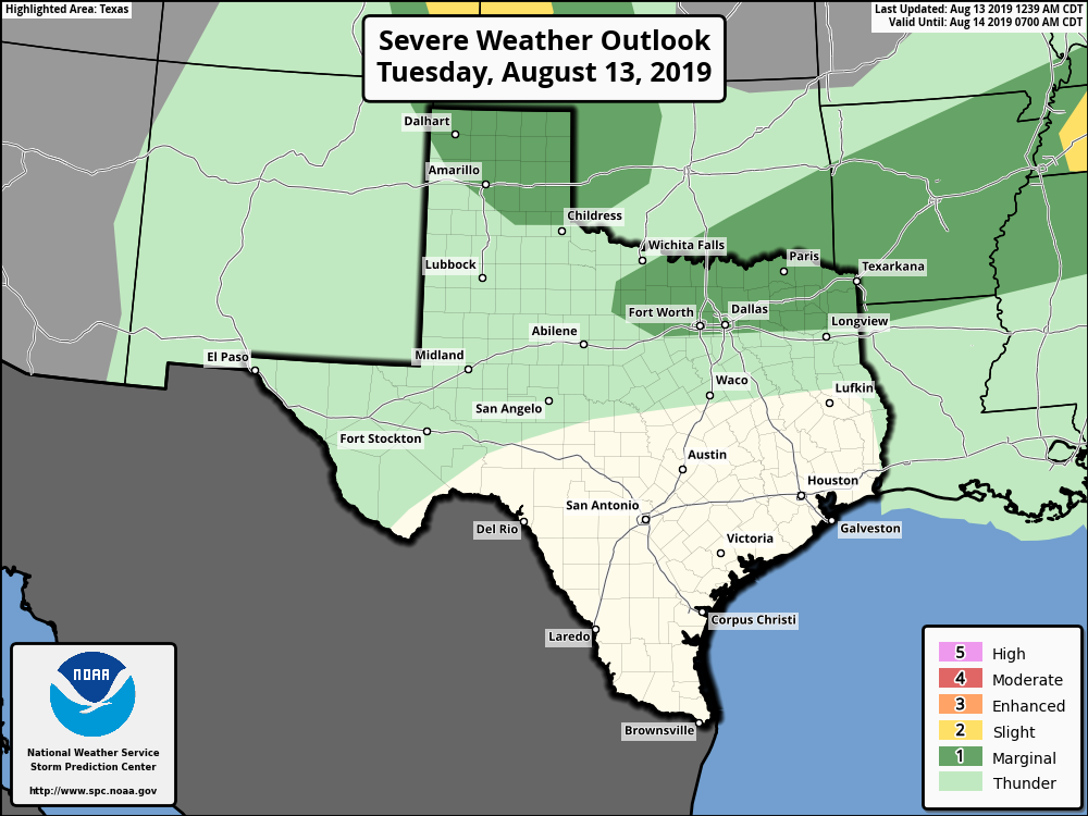 THURSDAY THROUGH THE WEEKEND: The surface front is expected to make it all the way to South Texas tomorrow night, and it looks like much of the stay will be dry for Thursday through the weekend. This means mostly sunny skies, lower humidity levels, and cooler nights. Highs will be in the mid to upper 90s, and lows in the upper 70s. NEXT WEEK: The upper high pattern rebuilds over North Texas next week, but will not be as strong as it is now. Highs will be in the upper 90s with lows in the upper 70s/low 80s. 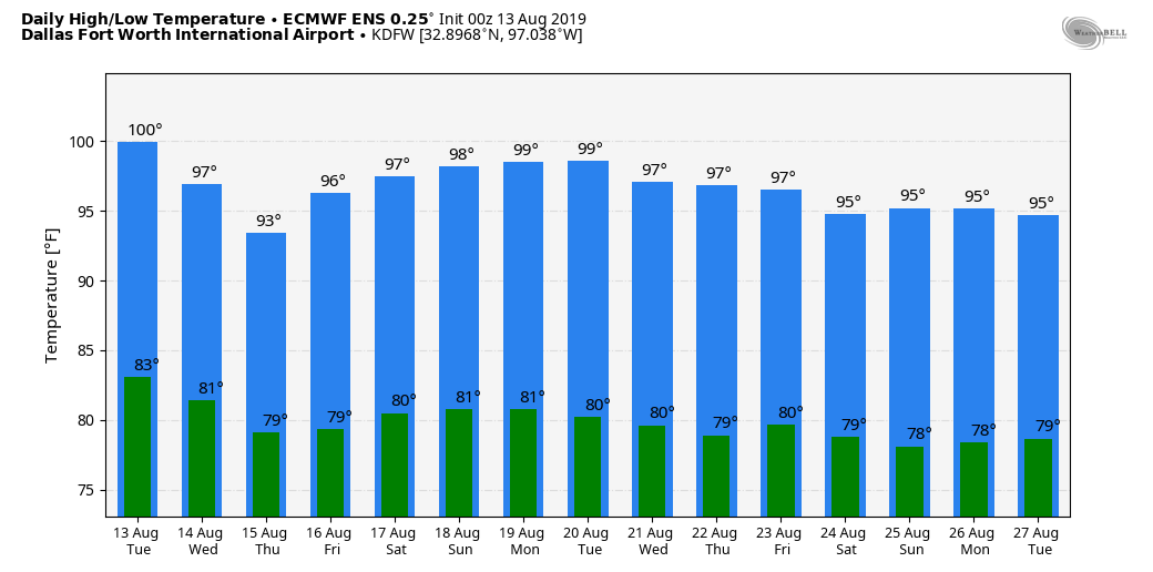 TROPICS: The Atlantic Basin remains quiet once again, and tropical storm formation is not expected through the week. There are only two occasions that the Atlantic has had zero named storms between July 15 and August 15: 1999 and 2015. 1999 was still an above-average season while 2015 was below average.
|
Archives
March 2023
Categories |
 RSS Feed
