
harvey close to landfall in texas, Dangerous Situation For The Southeast Part of the State8/25/2017 Radar Update - Your morning dose of showers and storms this time are located in Parker county and surrounding areas, where a Flash Flood Warning has been issued for parts of Southern Parker and Northern Hood county until 6:45 AM... 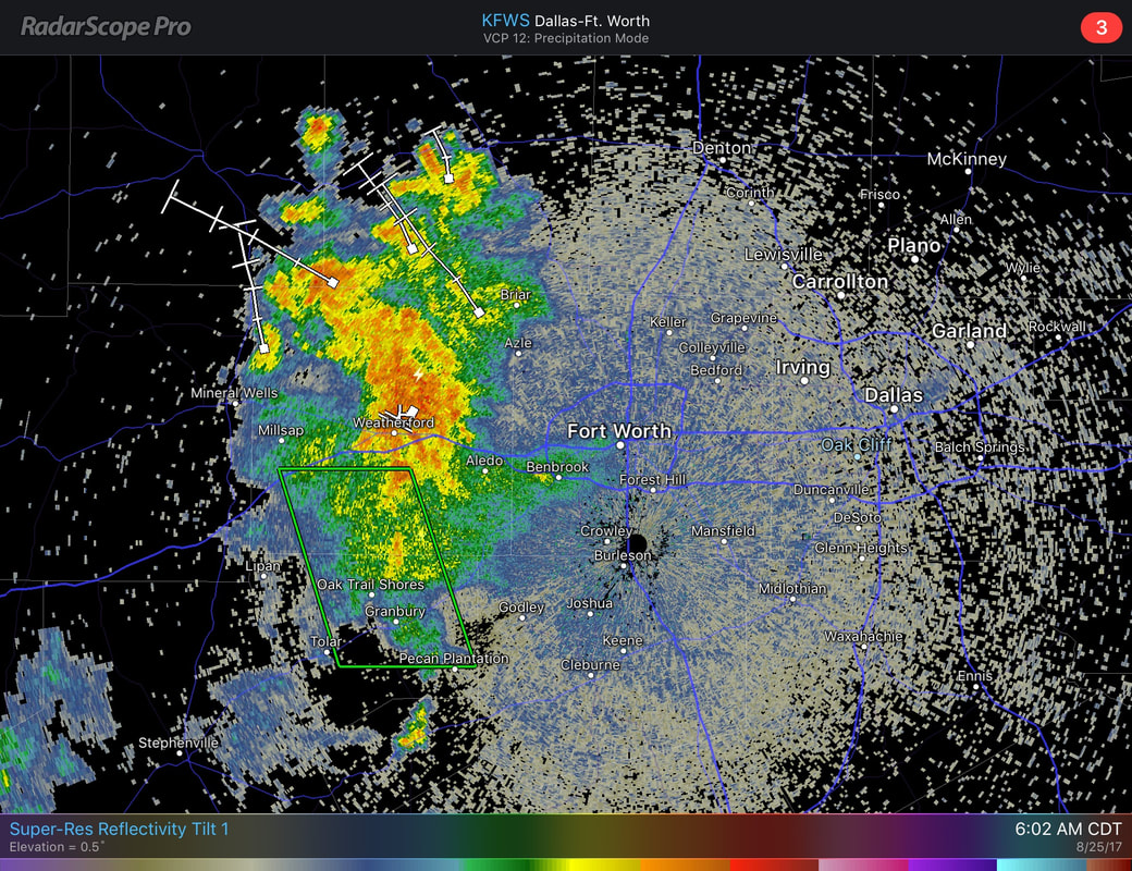 This complex is generally moving to the northeast, non-severe, producing heavy rain and frequent lightning at times. A good dose of clouds is possible today, with highs staying in the upper 80s for most locations. This Weekend - For us, a good supply of unusual dry air tries to seep into the region, limiting the amount of showers and storms about in relation to Harvey. There still will be surging moisture from the Gulf, so scattered showers and thunderstorms is not completely out of the question for the weekend. Expect mostly cloudy conditions with highs in the mid to upper 80s. The Week Ahead - All of next week will ultimately depend on how Harvey will behave, which will take its sweet little time to move. If Harvey drifts more to the north after stalling, it will most likely bring numerous showers and storms to the region Thursday and Friday. If it drifts more to the east, we could very easily stay dry for the latter half of the week. Models are continuing to work out some discrepancies about the placement of the storm, so understand that this forecast could very well change. Otherwise, early next week, we should see a good dose of sunshine with warm temperatures in the upper 80s to low 90s. We can also expect that for much of next week. 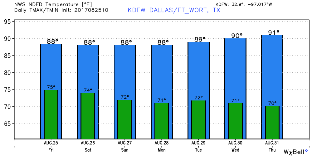 Harvey Intensifying Fast - A lot of things has transpired since tomorrow morning. Hurricane Harvey has intensified rapidly now as a strong category Two with max. sustained winds of 105 mph. It is expected to move into the Texas Coast tonight as a major hurricane (category three) with potential for max. sustained winds of 125 mph. This is expected to make landfall near Corpus Christi with significant potential for storm surge and flooding. 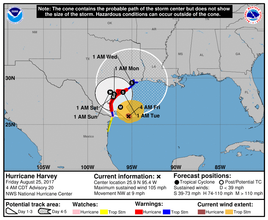 It has been over a decade since a major hurricane made landfall in the U.S.. Previous was Wilma on October 24, 2005. Steering currents in the area will collapse, which will cause Harvey to meander in Southeast Texas through early next week (Tuesday). This will create catastrophic and life-threatening flooding issues with rain amounts of 1-2 feet for the affected area. Not to mention, small, isolated tornadoes are also possible in the feeder bands of this storms. 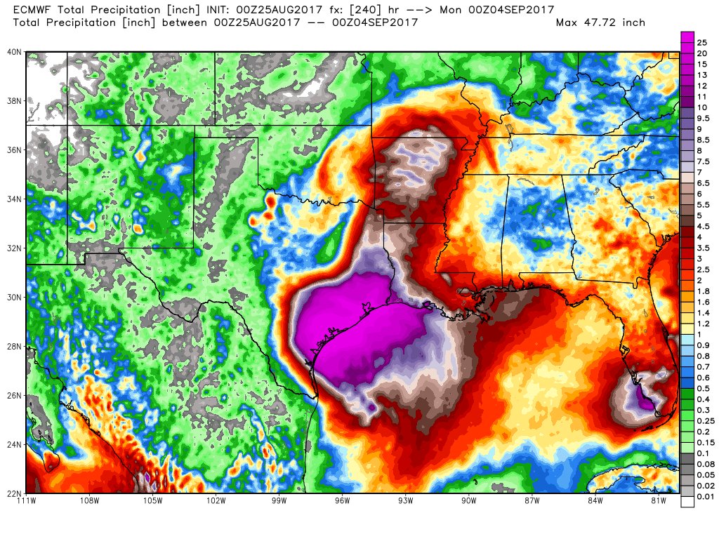 Invest 92L - A disturbance that is still over South Florida will move to the northeast this weekend, heading back into the Atlantic. It has the potential to become Tropical Storm Irma when it gets to the East Coast. The greatest threat for Florida will be heavy rain. No issues expected from this in North Texas. See the Texas Weather Discussion Video for more details.
|
Archives
March 2023
Categories |
 RSS Feed
