
|
Mild, Late Winter Afternoon - In fact, it feels more like spring across North Texas this afternoon. Temperatures are in the 70s across the board, with some places touching 80 this afternoon. Clouds are still in place for much of the state, and heavy rain is starting to become the main concern. In fact, a Flood Watch has been issued for most of the North Texas coverage as I am writing this. 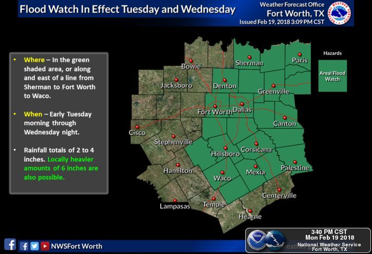 It is quiet now, but that will change after 6 this evening. Any storm that develops ahead of the main complex will have the potential to turn supercellular with potential for damaging winds and large hail. The tornado threat is low, but not zero. We will see most of the rain move through the area overnight into the pre-dawn hours tomorrow, which will make for a very wet commute to work and school. Most places will get 1" to 1.5" of rain during this time frame. High Amplitude Pattern - The high amplitude upper air pattern which features a deep, cold trough in the west and a warm ridge in the east will create flood problems for North Texas and parts of the lower Ohio Valley, where the WPC has outlined a moderate risk for excessive rainfall here in NTX.  Likewise, we have potential for record low and high temperatures for areas in each of the difference air masses. 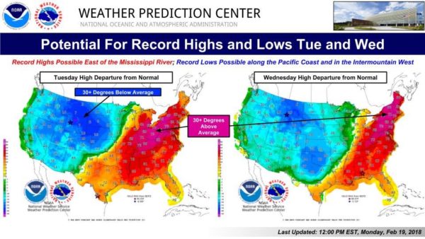 Here in Texas, we will continue to mention rain at times during the day on Tuesday, with widespread rain returning Tuesday night. Wednesday morning might be another wet commute. We should be in the mid to upper 40s on Wednesday, due to a cold front coming through. Luckily, we should be to the east of the freezing line, which will eliminate any chances of us seeing freezing rain for now. Thursday and Friday - Both days will be wet days with rain at time throughout the day. We will continue to forecast multiple rounds of widespread rain as we get closer. Highs should be in the low to mid 50s. Don't expect to see much sunshine this week. The Weekend - A surface front comes through Saturday, which will add more chances of showers and storms during the day. Again, rain at times with highs in the mid 70s. Sunday could actually be our first dry day in quite some time after the pattern loses its shape. If this were to verify, Sunday would be a dry day with mostly cloudy conditions along with afternoon highs in the low 60s. The surface front should push to the west near the lower Ohio Valley, where the SPC notably mentions a risk for severe storms on Saturday for that region. Next Week and Beyond - Next week will be mostly mild with highs in the low 70s. Rain could return during the latter half of the week, but won't be a washout like this week. 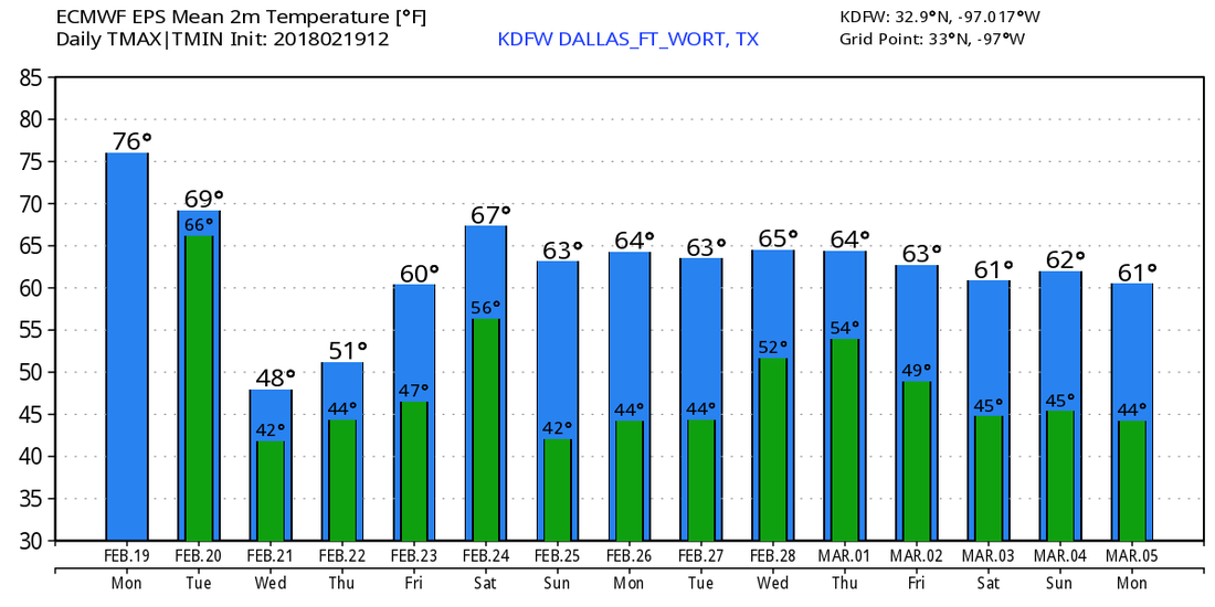 We see no freezing temperature issues for the next 10 days, though global models have been hinting that we could still see cold shots during the middle of March, which then raises the concern of severe weather issues. But, of course, that is to be expected since March is officially the start of the spring tornado season here in the Deep South and the Plains. See the Texas Weather Discussion Video for more details. 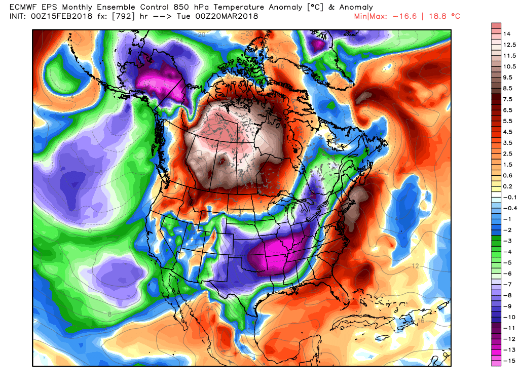 Today, we introduce one of our new producers/writers, Jonathan Williams! He will be frequently covering up to date stories of interest as well as updating the weather blog on the weekends! Be sure to follow him on twitter @wx_dfw!
|
Archives
March 2023
Categories |
 RSS Feed
