
|
RADAR CHECK - Light to moderate rain is moving northeast through our northeastern counties. The heaviest of the rain will move towards the Red River vicinity later this morning. If you missed having some rain this morning, don't worry, we will have another chance of rain this afternoon and evening with potential for a few strong to severe storms. Temperatures are currently in the upper 60s/lower 70s this morning. We expect highs to be in the upper 70s later today with more or less of a sun and clouds mix. A FEW SEVERE STORMS POSSIBLE THIS EVENING - In advance of another strong cold front, severe storms will be possible from around San Angelo through the Ohio Valley. A marginal risk (level 1/5) of severe storms runs through that area above. The standard "slight" risk (level 2/5) of severe storms runs through the DFW Metroplex northwards towards the lower Ohio Valley. 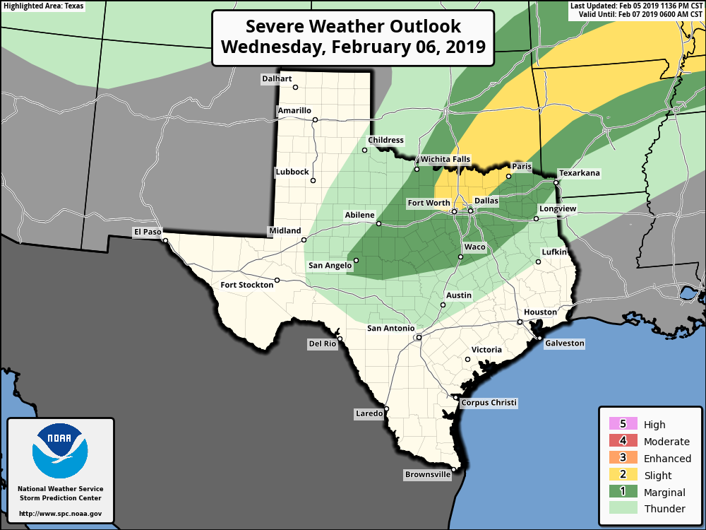 THREATS - More specifically, all modes of severe weather will be possible, including the potential for large hail, and a few tornadoes at times during the afternoon and evening hours. Thunderstorms will be more discrete in nature, so the tornado and hail risk will be a little bit higher in this scenario. However, we are NOT expecting an outbreak of severe thunderstorms. TIMING - Most of the severe storms will develop between 5-10PM over parts of North Texas, gradually tapering off overnight. Don't be alarmed if you experience rain during the day. This is just like any other risk of severe thunderstorms. No need to be alarmed or panicked about this. As long as you have a good safety plan in place and a reliable way to receive warnings quickly, there is nothing to worry about. THURSDAY THROUGH THE WEEKEND - After the cold front moves through, temperatures go the wrong way Thursday, with temperatures falling through the mid 40s by the evening hours. We turn sharply cold Friday morning with overnight lows in the mid 20s, and we only end up in the mid 40s with a mix of sun and clouds by the afternoon. We stay dry with afternoon highs in the mid 50s on Saturday, followed by another chance of showers and thunderstorms on Sunday once again, but we do warm to the low 50s. THE WEEKEND - At this point, much of next week (with the exception of Monday) looks partly cloudy and dry with highs mostly around seasonal averages. See the Texas Weather Discussion Video for more details. 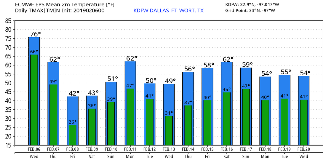 |
Archives
March 2023
Categories |
 RSS Feed
