
|
FEELS LIKE SUMMER - A very persistent upper meter high will remain parked over the central and eastern third of the country for at least the next two to three days. This means temperatures here in North Texas will remain generally above average. While we are experiencing late-summer time heat in October, parts of North Dakota are experiencing their first snow of the season. This was taken from one of North Dakota's NDDOT cameras yesterday morning. 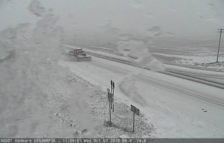 We are projecting mostly sunny skies and very warm days with fair nights today and tomorrow. Afternoon highs will be close to 90 degrees with lows in the 68-74 degree range. The chance of one spot getting wet is less than five percent, not even high enough to mention in a forecast. THE WEEKEND - A strong cold front approaches from the north on Saturday, but doesn't quite make it towards North Texas. We will mention a slight chance of scattered showers and thunderstorms on Saturday, depending on how south the front gets. Then, moisture increases drastically on Sunday, and that's when we will see the better chances of showers and thunderstorms. The best chance of one spot getting wet on Sunday is 50/50. We do note that with a digging trough in the west, there is enough to support a risk of severe weather for the Texas Panhandle and parts of West Texas on Sunday.  At this point, it is too early to know the exact timing and impact of severe storms this weekend. Highs will be in the mid 80s on both days.
NEXT WEEK - Our rain chances will linger into next week the storm system finally starting to move eastward. If the ridge in the east moves farther to the east, we will then mention the risk of potential severe storms for North Texas. But we will worry about that with time. Our best chance of rain looks to be Tuesday, when the system moves to the northeast. The latter half of the week should be dry with highs in low 80s to upper 70s. See the Texas Weather Discussion Video for more details. TROPICS - Hurricane Leslie is still in the Central Atlantic, far from land. It will continue north, then turn east later this week. A disturbance in the Caribbean has a 30 percent chance of development over the next five days as it moves to the north. |
Archives
March 2023
Categories |
 RSS Feed
