
|
Radar Check - We do note a few showers this morning on the map. Nothing widespread, just some light to moderate rainfall. 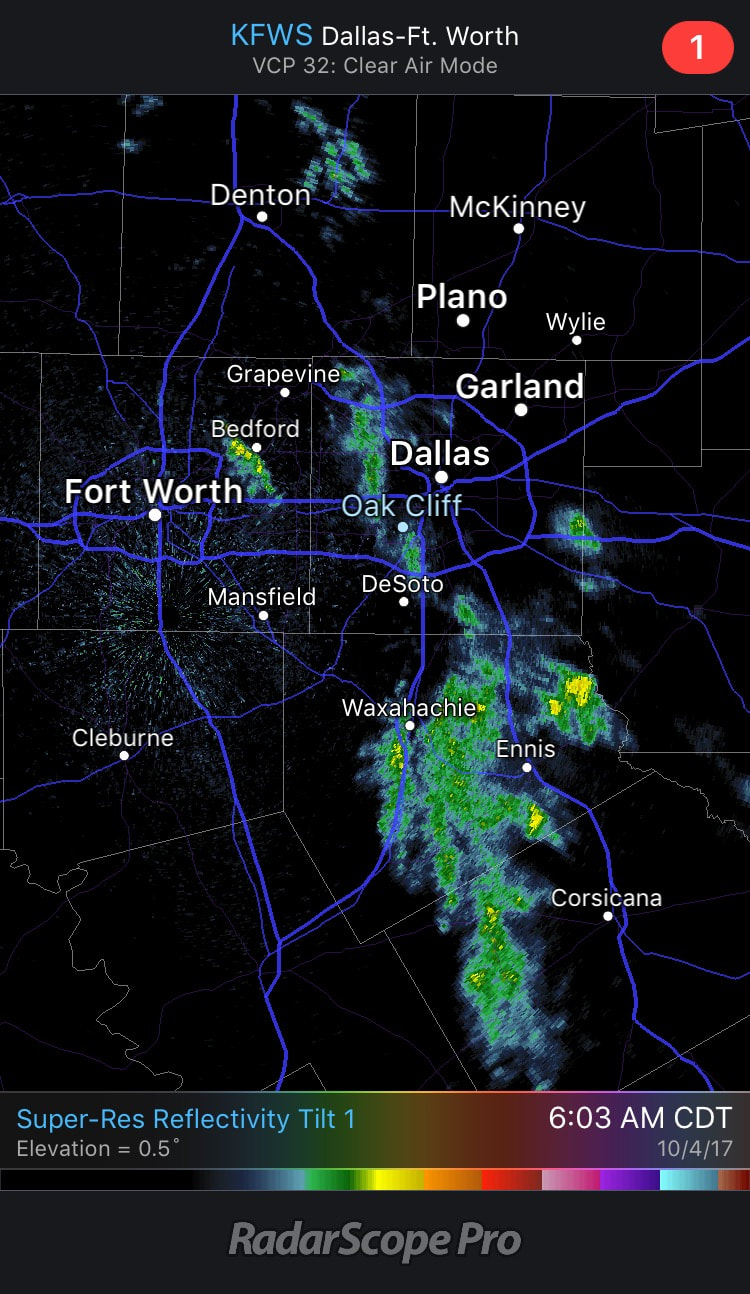 Although this is supposed to taper off by the afternoon and evening hours, the chance of rain will be low, but not zero. The high today will be around the 84-87 degree mark with clouds still sticking around. And we note that quiet, warm weather is in stock for us tomorrow and Friday. While we have that, the western U.S. will continue to be cold and unsettled; some parts of Montana has received two feet of snow. What's Going On Now In The Gulf? - Confidence is now high that a tropical depression or a storm forming in the Gulf of Mexico during the next 48 hours. This system will travel to the north or northeast, going through the Gulf of Mexico during the weekend. Beyond that time frame, we can't give you any other specifics. The Disturbance (Invest 90L) is located in the Southern Caribbean, just off the coast of Central America. Until this disturbance gets better organize, and we are able to receive data from hurricane hunters later this week, models will continue to struggle and disagree on a solution. The American global model, the GFS, features the system making landfall near New Orleans on the Louisiana Coast. However, the better-performing European model (ECMWF) shows landfall close to Tampa and Tampa Bay. Going forward, here are a few key points for any potential questions... *If you have a beach vacation planned this weekend, I would not cancel yet. Simply too early to know the final outcome of the tropical situation, but you do need to be aware that a tropical storm could form and be a high impact event for some part of the Central Gulf Coast. *The amount of rain in Southeast will all depend on the track of the tropical low. If the Euro solution is correct (landfall near Panama City Beach, with a movement into Georgia), when we will be on the “dry side” of the system with some rain certainly possible on Sunday and Monday, but the heavier totals will be east of the region. On the other hand, if the GFS is right, then, the Southeast will get a good wet down Saturday and Sunday. *The name of the system, if it becomes a tropical storm, will be “Nate”. Just keep an eye on the blog for updates as the weekend gets closer. 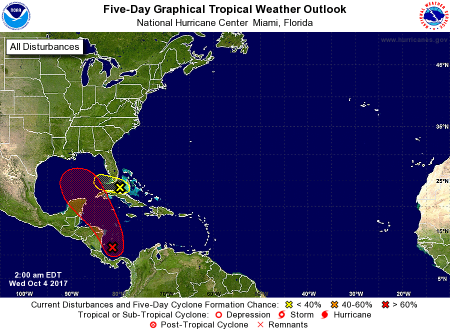 Next Week - Next week looks quiet with a strong cold front coming through which will significantly bring temperatures down. See the Texas Weather Discussion Video for more details. 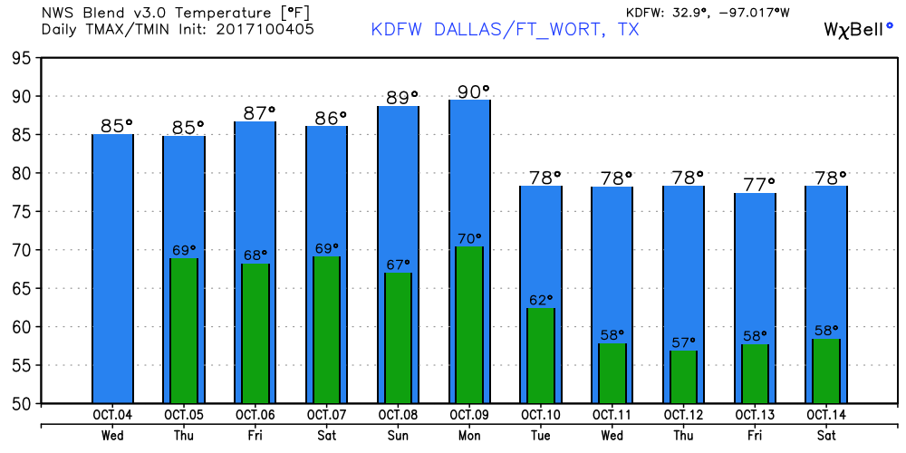 |
Archives
March 2023
Categories |
 RSS Feed
