
|
FALL-LIKE WEATHER CONTINUES - For most of North Texas, dry weather continues today; the sky will feature a mix of sun and clouds with a high in the low 70s. Clouds will thicken during the overnight hours. WEDNESDAY/THURSDAY - High wave energy from Hurricane Willa in the eastern Pacific will spin up a surface low in the Gulf tonight. The feature will move northward, and will bring the chance of widespread rain statewide. The best window for widespread rain is Wednesday afternoon/early Thursday morning. The rain will end from west to east Thursday afternoon as the low moves eastward. Temperatures will hold in the 50s for most spots on Wednesday, well below our average high for late October. Rain amounts of 1/2 - 1 inch will be possible for most areas in North Texas, with over an inch possible for the central part of the state. FRIDAY AND THE WEEKEND - Friday looks dry with a mixture of sun and clouds with highs in the low 70s. Sunshine will be in full force Saturday and Sunday with highs in the mid 70s and upper 60s with morning lows in the upper 40s to low 50s. NEXT WEEK - Monday and Tuesday look mostly dry with a mix of sun and clouds... Some rain returns with mostly cloudy skies during Halloween and the first of November with an approaching front. See the Texas Weather Discussion Video for more details. 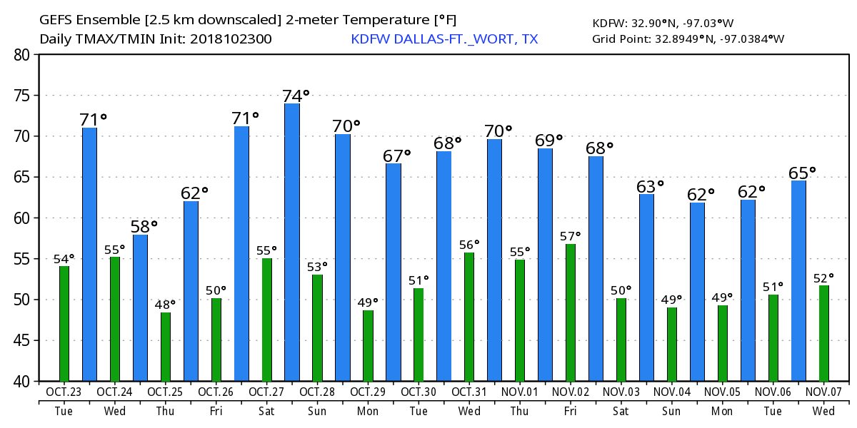 TROPICS - The Atlantic Basin continues to remain very quiet. However, in the eastern Pacific, Hurricane Will will landfall on the Mexican coast as a Category three hurricane later today. It will dissipate in Northern Mexico tomorrow afternoon, but moisture from the system will move into Texas. 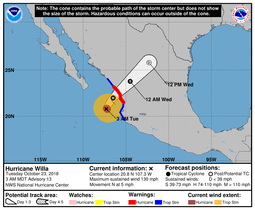 |
Archives
March 2023
Categories |
 RSS Feed
