
|
CLEAR MORNING - Nothing but dry weather and clear skies across our great state of Texas this morning; temperatures are mostly in the mid to upper 60s. Today will be dry and warm with increasing clouds by the afternoon. Highs will be in the upper 70s for most communities today. HALLOWEEN - We are forecasting a mostly wet, rainy, and cool Wednesday with widespread scattered showers and thunderstorms across the region throughout the day as a cold front and a dynamic weather system moves into Texas from the west. The SPC has much of the area to the southeast of North Texas in risks of severe thunderstorms on Wednesday, and we in North Texas will certainly have the potential for a couple of those. 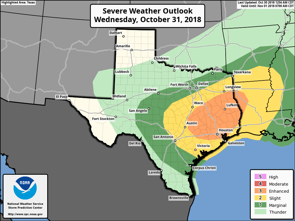 - It looks like the best chance of severe weather tomorrow will come over the southern half of the state where instability values are much higher by the afternoon and evening. - Storms over Southern Texas will have the potential of producing damaging winds and large hail. A brief tornado or two can never be ruled out, based on shearing profiles. - The main window for the most widespread rain will come from 10:00 a.m. - 10:00 p.m.. - Rain amounts will range anywhere from an inch to two and a half inches across North Texas. Of course, the forecast will be fine tuned more throughout the day as confidence increases. FRIDAY AND THE WEEKEND - The sky will be mostly sunny on Friday as drier air rolls into the state. Friday will be in the upper 60s. Then, we expect a pleasant weekend ahead full of sunshine Saturday and Sunday. Highs will be in the 70s with lows in the mid 50s. NEXT WEEK - Most of next week looks pleasant and dry with average temperatures... See the Texas Weather Discussion Video for more details. 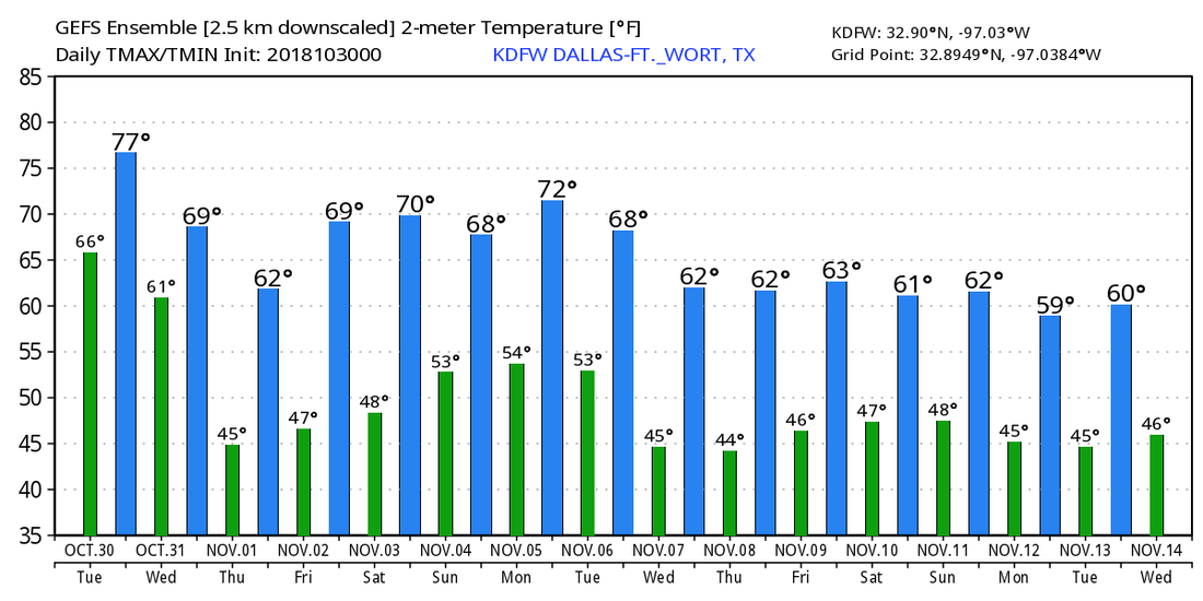 TROPICS - Hurricane Oscar is still in the Central Atlantic as a category two with max sustained winds of 105. It will move to the north, northeast, away from land in coming days. The rest of the Atlantic Basin is quiet. 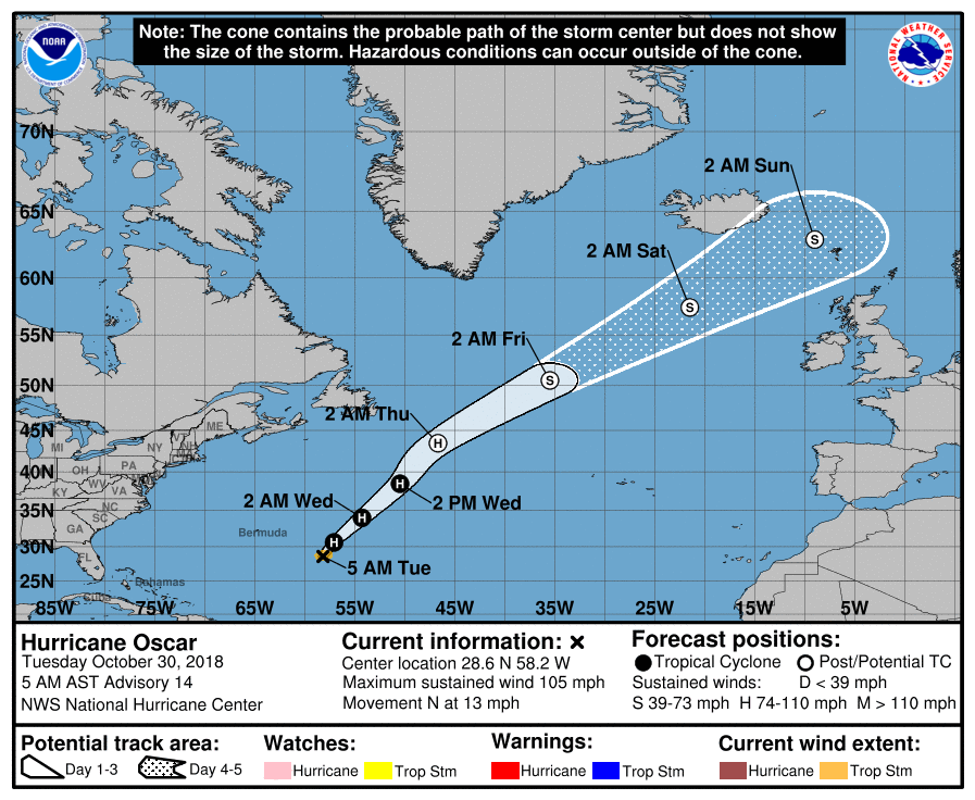 |
Archives
March 2023
Categories |
 RSS Feed
