
|
SHARP TEMPERATURE CONTRAST: A stalled front is providing a big contrast in temperatures this morning; 40s and even 30s can be found for areas behind the front with warmer conditions ahead of the front. The day ahead will be dry with a mix of sun and clouds. Temperatures will be in the mid 60s for daytime highs. MORE RAIN AHEAD: Clouds will increase tonight, and showers and light rain returns overnight for the northern part of the state. The best chance of rain will lie in North-Central Texas. We will mention showers at times through Tuesday morning, but coverage of precipitation will begin to increase during the afternoon, and all of North Texas will have rain at times Tuesday evening through Wednesday afternoon. There could be some thunder involved, but for now, the risk for severe weather is very low. It will be another beneficial rain event for the state, with rain amounts of 1-3 inches possible. 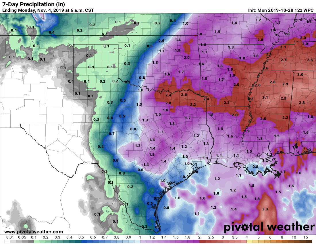 The latest guidance suggests an end to the rain from west to east Wednesday evening, meaning a dry day for the trick-or-treaters on Thursday with the sun returning. However, we will experience the coldest air so far this season as we drop to the 32-36° range early Thursday morning, with potential for a freeze in some spots over North Texas. There could be a possibility of ice on some bridges and roadways during the morning commute for any leftover rain, which will be more of a hazard if rain continues Wednesday evening. We will continue to fine tune this forecast as we get closer to Halloween. FRIDAY AND THE WEEKEND: Very cold air will hang around for the weekend, meaning each day will start in the low to mid 30s. Saturday and Sunday will be dry with sunny, cool days and clear, cold nights. Highs over the weekend will be in the 56-63° range, with lows in the upper 30s. Frost is likely in some isolated spots. NEXT WEEK: Most of next week is looking dry right now with our next chance of rain coming Tuesday, but it is a small chance. See the Texas Weather Discussion Video for more details. 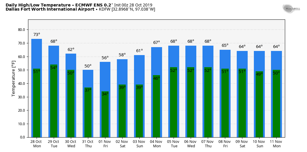 TROPICS: Pablo, a tropical storm in the North Atlantic, will continue to dissipate today. Otherwise, the Atlantic Basin remains quiet. The hurricane season will continue through November 30.
TIME CHANGE: Daylight Saving Time ends this weekend, which means, we will set the clocks back an hour later Saturday night. The sunset time on Sunday, November 3, will be 5:35 PM CST. |
Archives
March 2023
Categories |
 RSS Feed
