
|
WARMING BACK UP: Temperatures are currently in the mid to upper 70s with a few 80 degree readings across the region. The air continues to remain relatively dry across North Texas, and today will be another sunny day with a high around 90°. THE WEEKEND: Mostly sunny, hot weather continues tomorrow with a high in the low 90s. Then moisture levels rise Sunday morning with the chance of isolated/widely scattered showers and storms during the pre-dawn hours. Then, a complex of storms move in from Oklahoma by the overnight hours. Some storms could be strong, which is why the SPC has a "marginal risk" (level 1 of 5) of severe storms for the metroplex. Rain will continue into the morning hours on Monday. The high Sunday will be in the 90-95 degree range with more clouds than sun. NEXT WEEK: Rain will continue to linger until the afternoon on Monday. Then, we go back to routine June weather through midweek with the daily chance of "isolated, mostly morning to afternoon showers and thunderstorms". Highs will be in the upper 80s to low 90s, and lows will be in the mid 70s. The storms each day will be fairly isolated and not widespread. See the Texas Weather Discussion Video for more details. 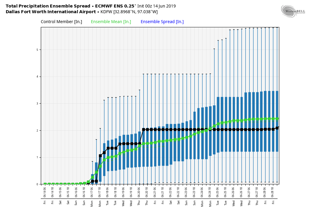 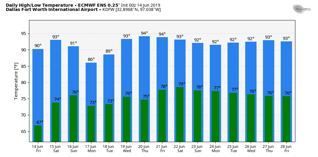 |
Archives
March 2023
Categories |
 RSS Feed
