
|
UPPER LEVEL HIGH - Anomalously dry air will continue to circulate over North Texas for the next several days as our upper high pattern continues, which will set the stage for mostly sunny, very hot days and mild nights. Highs will be in the mid to upper 90s with lows in the 70s. An isolated shower or two is definitely not out of the question from time to time, but most of the region remains rain free for the next several days. THE WEEKEND - Not much change. We get somewhat hotter over the weekend as the upper high strengthens. We will roll with a persistent forecast of mostly sunny, very hot days with afternoon highs in the mid to upper 90s. Some places could actually reach 100° by Friday and Saturday. NEXT WEEK - The upper high pattern stays in Texas for a while, so look for mostly sunny and hot afternoons each day with highs in the mid to upper 90s, fairly anomalous for late August. See the Texas Weather Discussion Video for more details. 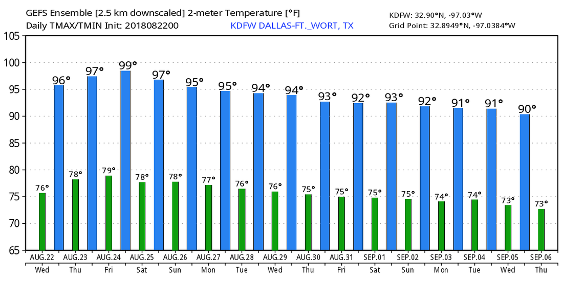 HURRICANE LANE NEARS HAWAII - Hurricane Lane is now a Category Five storm with maximum sustained winds of 160 mph. It will weaken as it continues to move northwest, but the NHC track will have Lane pass just to the west of the islands, but still dangerously close for major impacts. Just know that if the center wobbles to the north by just a little bit, that could put the island under a real emergency. Rain amounts of about a foot are likely, with isolated amounts of two feet possible. Dangerous rip currents and storm surge is expected, along with very, very strong winds. 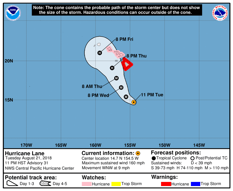 |
Archives
March 2023
Categories |
 RSS Feed
