
|
COMFORTABLE START - Temperatures are mostly in the mid to upper 50s across the great region of North Texas this morning, which is about average for this time of the year. That upper low and front that produced rain on Wednesday is well off to the east, and we should continue to feature pleasant days with abundant sunshine with highs in the upper 70s. Some places might reach 80 today. THE WEEKEND - The weekend outlook looks absolutely perfect for any outdoor activities. The sky will feature abundant sunshine with a few clouds at times. Highs will be in the low to mid 80s though, so it will be quite mild, but dry. Be sure to get any outdoor acitivties in this weekend, because rain and storm potential will increase next week. NEXT WEEK AND BEYOND - The first two days of next week look mostly dry, though clouds will most likely overspread the region as the flow of low-level moisture starts to increase. Our real chances of scattered showers and thunderstorms begin Tuesday and Wednesday with a classic triple--point setup in Oklahoma and Kansas. Those rain chances for us will continue through Friday morning. Highs will mostly be in the mid 80s during the week. Next week will also be more active in terms of our severe weather season (or lack thereof). The SPC has parts of the plains in a risk of severe weather everyday until Thursday. 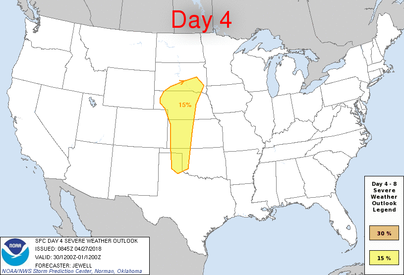 Each day will feature at least some risk for severe thunderstorms, including the potential for supercells, especially on Wednesday over parts of Central Oklahoma and Kansas. I'm already starting to see the 'o' word being thrown around social media. At this time, it is too early to specifically forecast any severe weather hazards. Just know that all modes of severe weather will be possible, including the potential for large hail and a few tornadoes. Also recognize that it is also too early to describe exact placement, and timing, and all of those details will be refined over the weekend. But the good news is that we can expect to see more precipitation over the next two weeks. The Climate Prediction Center calls for above average precipitation values for parts of Texas extending into the lower Ohio Valley. See the Texas Weather Discussion Video for more details. 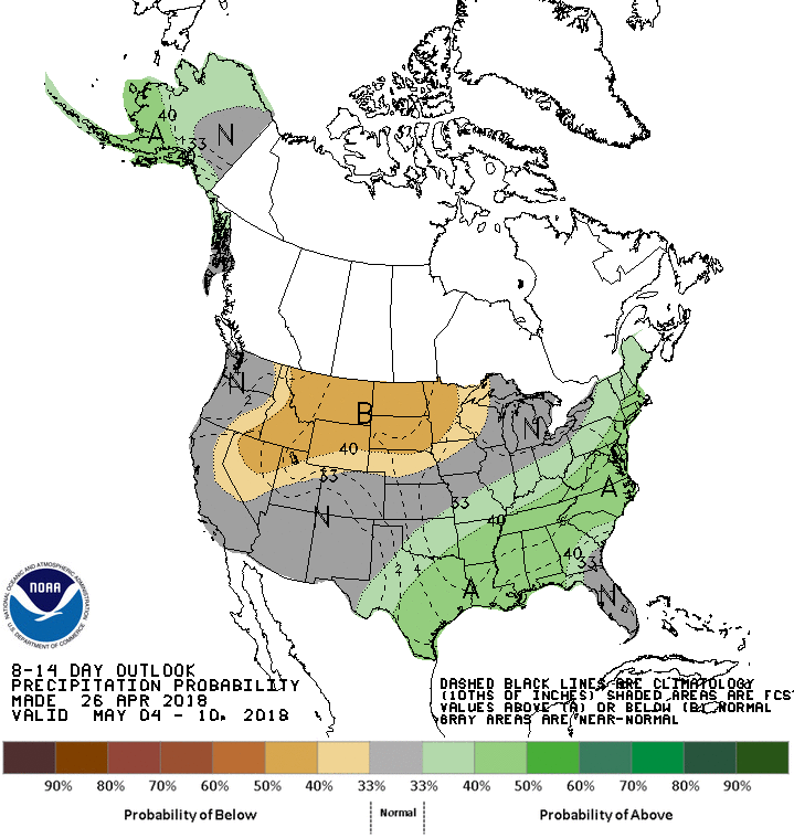 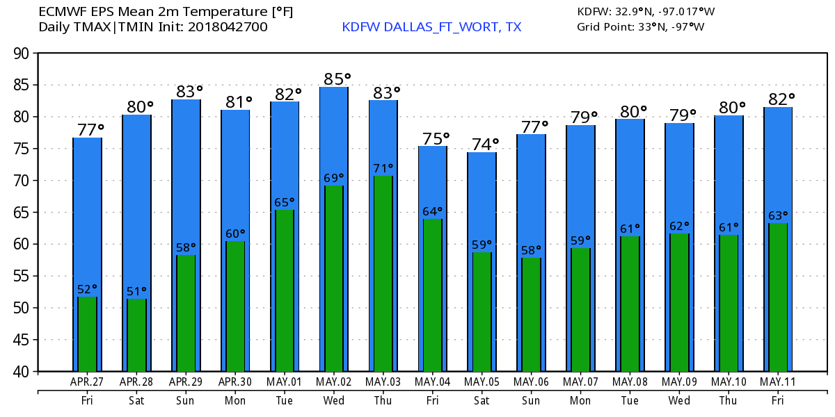 ON THIS DAY IN 2011 - Today marks the 7th anniversary of the generational tornado outbreak of April 27, 2011. This was the deadliest High Risk Day on record; the event set record for the most tornadoes recorded in a 24-hour period. Also included a 45% tornado area which is above the minimum threshold for a high risk. Also produced the only known watch (Particularly Dangerous Situation (PDS) Tornado Watch 235) with a >95% of all severe and significant hazards. 218 tornadoes touched down; Four were rated EF5. In addition to 317 deaths, over 2000 were injured.
|
Archives
March 2023
Categories |
 RSS Feed
