
|
RADAR CHECK: Strong to severe storms have developed in the Big Country this afternoon and are continuing to move to the southeast this evening. Some of these storms are severe with 60 mph winds and up to half-dollar sized hail, with flooding being a possibility with those that experience torrential downpours. The SPC maintains a low-end "marginal risk" of severe thunderstorms for much of the southern half of the North Texas region through the evening hours. The heavier storms could produce small hail and gusty winds. 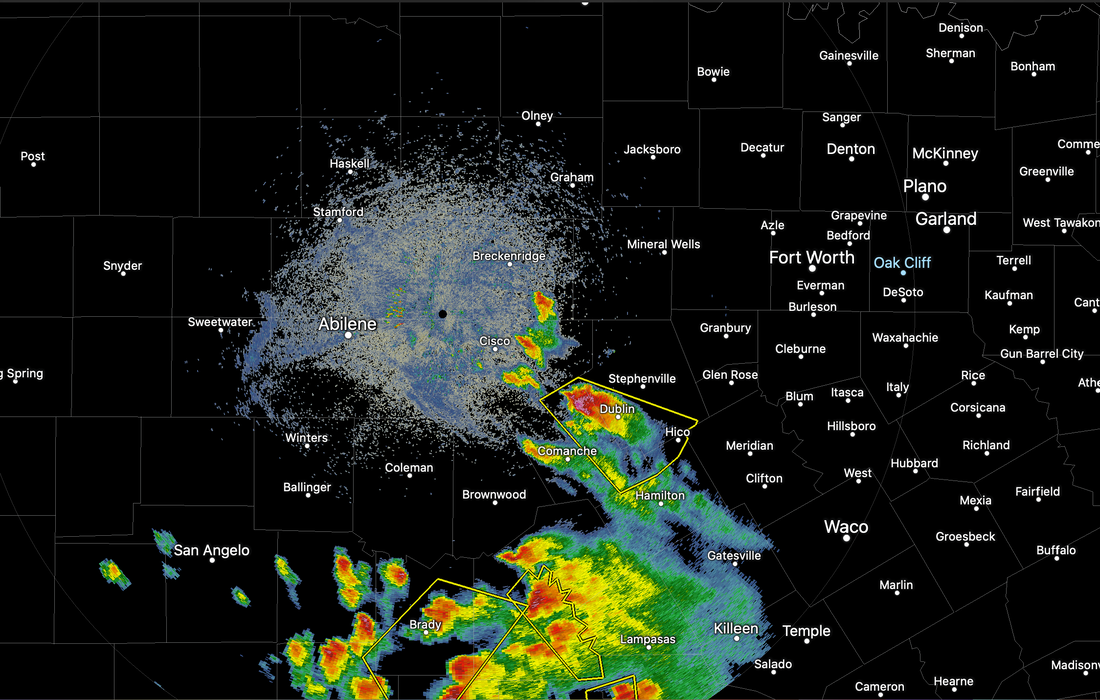 Temperatures remain mostly on average with readings mostly in the mid to upper 80s. The average high for Dallas/Fort-Worth on May 27 is 84. The upper low will continue to move slowly eastward, and we expect mostly dry conditions tomorrow, followed by completely dry weather by Friday. An isolated storm or two is possible on Thursday. We expect highs in the mid 80s tomorrow and Friday, with a good supply of sunshine. THE WEEKEND: Unusually dry air drops into the state over the weekend. Look for sunny days, fair nights, with a tad lower humidity levels. We will continue with highs around 85-87 Saturday and Sunday... many places will see lows in the low 60s Saturday morning. Very average to the end of May here in North Texas. NEXT WEEK: The weather looks very dry next week with a warming trend. Afternoon highs will reach the low to mid 90s by the end of the week. Showers and storms will be very limited in number, if any. 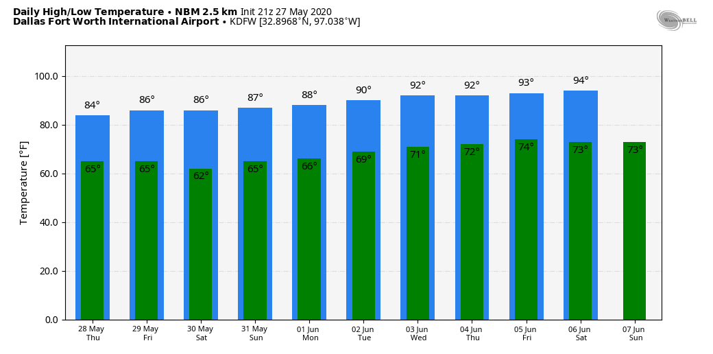 TROPICS: Tropical Storm Bertha formed quickly early this morning, just off the South Carolina coast. It is now inland, moving northward producing heavy rain as a tropical depression. The rest of the Atlantic Basin is quiet. The official start of the 2020 Atlantic Hurricane Season is June 1.
Look for the next weather discussion and blog update by noon tomorrow. Donovan Neal Owner - ApexStorm |
Archives
March 2023
Categories |
 RSS Feed
