
|
DRIER AIR OVER TEXAS PANHANDLE - Drier air covers some of the counties in the Texas Panhandles at 10:00 AM this morning. A weather station in Dumas recorded a temperature of 79°, which is abnormal for this time in July. Deep moisture covers much of North and Central Texas this morning, which is where we expect the greatest coverage of scattered showers and thunderstorms today and tomorrow. 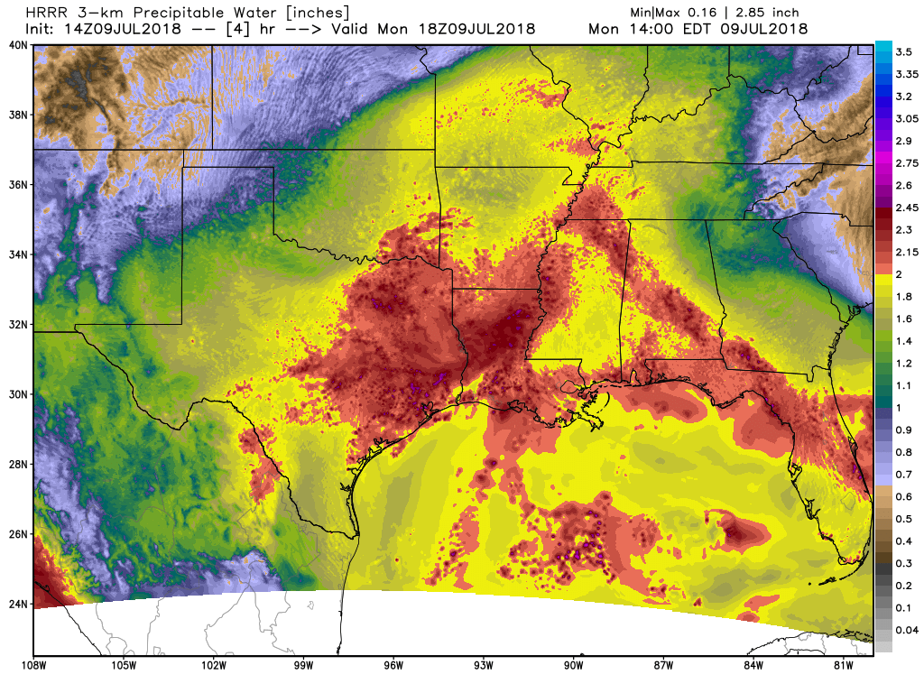 Highs this afternoon will be in the mid to upper 90s in most spots. MIDWEEK - As we get towards the latter half of the week, the coverage of showers and thunderstorms during the afternoon and evening hours will lessen as drier air starts to filter in from the north. By that time, the best chance of any one spot getting wet will be in the 20 percent range. We will still have a mix of sun and clouds with afternoon highs in the mid to upper 90s. THE WEEKEND - We start to get back with routine summer-time weather for Texas; mostly sunny and humid with an isolated afternoon storm or two. Highs will be in the upper 90s to low 100s. NEXT WEEK - We start to get into the "dog days" of summer with mostly sunny skies, hot and humid conditions with highs in the upper 90s and low 100s during the afternoon. 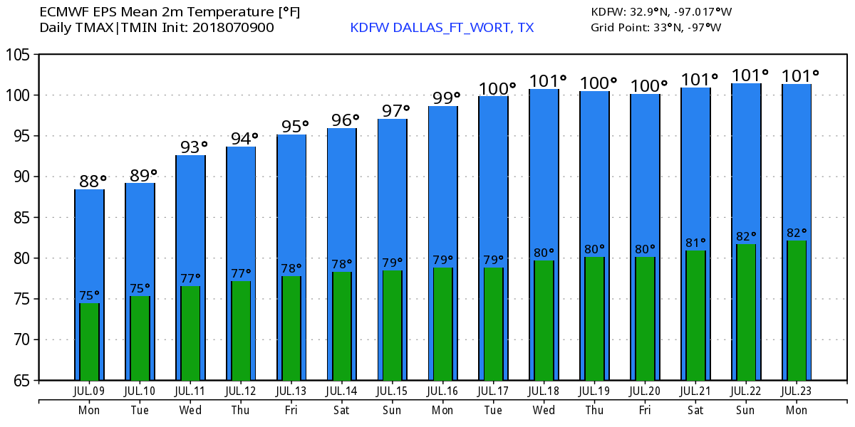 TROPICS - Tropical Storm Chris is stationary off of the Carolina coast with maximum sustained winds of 60 mph. It is expected to become a hurricane tomorrow, but won't today because of sitting over the same water for a long time with cooling SSTs and drier air starting to filter in. But that should filter out as soon as it starts moving. 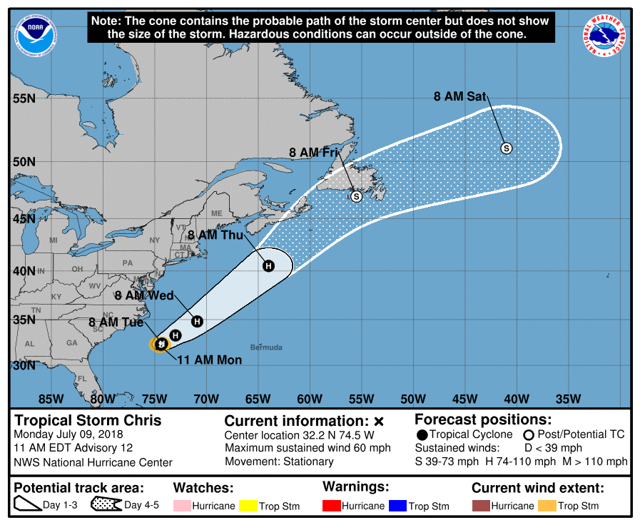 AS FOR BERYL - Tropical Storm Beryl dissipated yesterday. But, it is not completely off the board yet. It still has some chance of regenerating into a tropical cyclone near the Bahamas in the next 5-7 days. It will make a turn to the northeast and kick off to sea.
No tropical cyclones are expected to impact the Gulf of Mexico or southern U.S. for the next 5-7 days. See the Texas Weather Discussion Video for more details. |
Archives
March 2023
Categories |
 RSS Feed
