
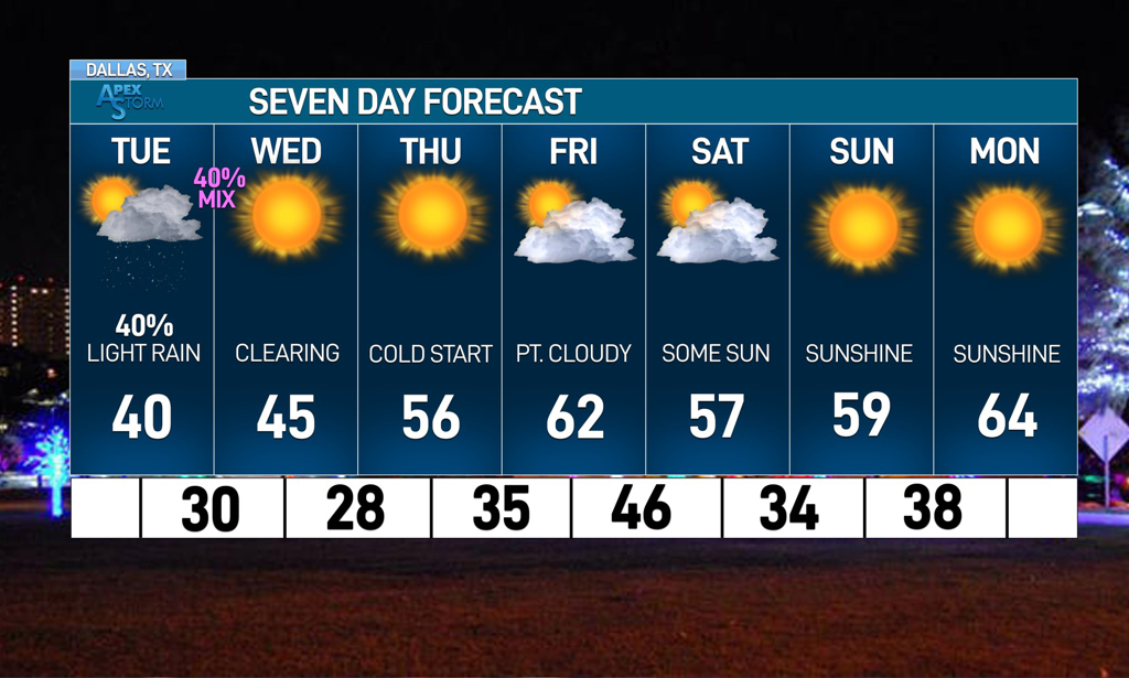
 Hello everyone! I’m back with another updated blog for our next week of weather. Many areas across North Texas saw some flakes last night with some wrap around precipitation after Sunday’s upper-level low! It marks the first wintry precipitation much of the region saw this winter, though many places still didn’t see anything. However, there is another upper level low moving over North Texas tomorrow and there are a lot of uncertainties on what will happen. I’ll take a look at it in this blog. TUESDAY SNOW? Overnight tonight, an upper level low will move from northwestern Oklahoma to over North Texas, with a track somewhat similar to the system from yesterday. There will be a high amount of dry air aloft throughout the bulk of the day despite a very moist DGZ, reducing any potential for rain as the day progresses. While Oklahoma is projected to get a decent amount of snow throughout the day, the chance for precipitation is negligible for DFW and surrounding North Texas areas, with any precipitation that does fall being very light. However, as the low moves through the area, there is a potential for wrap around wintry precipitation for parts of North Texas. Global model guidance has neglected the potential for anything wrapping around, but new high resolution guidance is trending towards a greater precipitation shield. Southerly flow will create a shallow warm nose before a bulk of precipitation tomorrow in the morning and high-res guidance assumes precipitation will overcome it easier, which the HRRR uses to lower temperatures by the end of the day and introduces the possibility of flakes for DFW by about 7 pm with light accumulations across the northern suburbs. While this solution is exciting, it’s less probable because it assumes a colder thermal profile than what might be present. The dynamic nature of this system makes a larger range of possibilities possible, even just a few hours out. We at ApexStorm are erring on the side of a wintry mix of rain and snow possible for some northern counties, with a larger chance of a sleet/snow mix possible along the Red River basin. Confidence is increased due to the success of the models from yesterday with them sniffing out the flakes that fell over the northern counties of DFW. It’s exciting to think about but remember, this is a very slim chance. Almost all of the wintry precipitation will occur in Oklahoma, with places like OKC getting between 2 and 4 inches. Hopefully the success of Oklahoma, who is having their 3rd winter event of the season already tomorrow, leads to good things for DFW’s winter prospects. 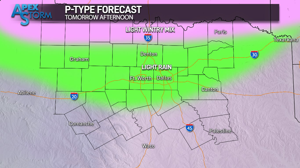 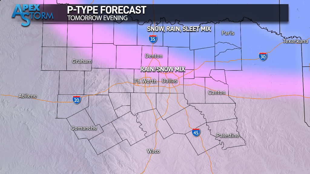 LOOKING FORWARD:
Wednesday will have clearer skies and begin the trend of warmer weather for DFW through the end of the week. Thursday and Friday will have seasonal temperatures with a ridge setting up over Texas. A small shortwave will bring the chance of precipitation overnight Friday that then gives way to even warmer temperatures in the 60s over the weekend. The presence of the upper level system will mean periodic clouds throughout the weekend as well. The next week should also have pleasant, seasonably warm temperatures as we head towards Christmas where an EPO dump might bring North Texas’s first good chance at a wintery system. Stay tuned, stay warm, and stay weather aware! -Colin Welty |
Archives
March 2023
Categories |
 RSS Feed
