
|
Chilly Start - Temperatures are in the mid to upper 40s for most of the north Texas region this morning; a typical mid march morning. Today will be cool and breezy today as astrological spring officially begins at 11:20 PM today. Today's high will be in the mid 60s. Wednesday Through Friday - With abundant sunshine, we begin a warming trend with afternoon highs in the mid 70s on Wednesday, near 80 degrees on Thursday, and low to mid 80s on Friday. We will start each day in the 52-64 degree range. The Weekend - An unsettled weather pattern begins this weekend. A surface low forms somewhere in the Panhandle on Saturday, which will set off a few showers and isolated thunderstorms during the afternoon hours. A greater rain threat will begin on Sunday, where chances are much higher. Rain will linger into the early part of next week, and rain amounts will be above the 1/2 inch range. Highs will be in the low to mid 80s. Next Week - Our pattern remains somewhat unsettled for at least the early part of next week with a chance of isolated showers and storms each day, then we run dry for the latter half of the week. Highs will be in the low to mid 70s, just about average for this time of the year. See the Texas Weather Discussion Video for more details. 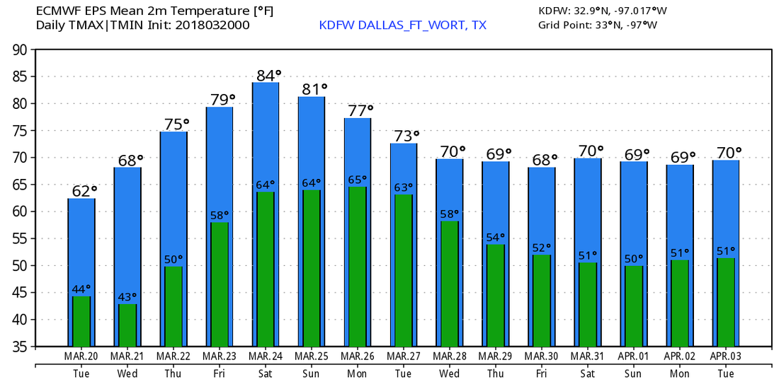 |
Archives
March 2023
Categories |
 RSS Feed
