
|
Chilly Start - As we begin the first workweek of April, we start out pretty chilly due to a strong cold front that came through during the late afternoon yesterday. Temperatures are mostly in the low to mid 40s this morning. We should remain cloudy for much of the day with highs only reaching the low 60s at best. We will need to mention the chance of a few scattered showers during the afternoon, but most places will remain dry. Tomorrow - We turn much warmer as we start the day in the low 60s this time. Our chances of a thunderstorm turning severe are higher on Tuesday, especially within the standard "slight" risk for severe storms, defined by the Storm Prediction Center. 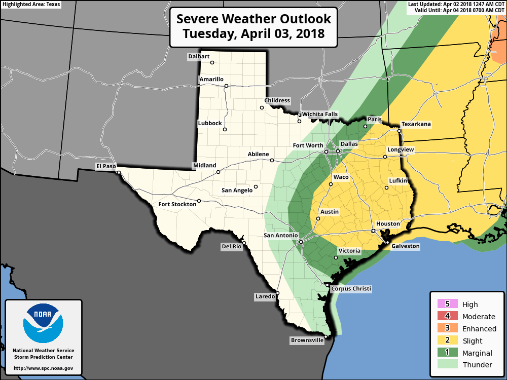 In DFW, we are outlined in the marginal risk for severe storms Tuesday afternoon and evening. Timing - If anything, we will see a band of rain develop towards noon & move to the east, then we will start to see storm initiation at around 3PM in East Texas once the cap breaks. These storms should quickly move to the east, so flooding should not be a concern. Threats - For DFW, the main thing we will have to worry about is damaging winds for any of the storms that can turn marginally severe. In the standard risk zone, damaging winds will be the prominent threat with the formation of a squall line. Steep mid-level lapse rates suggest that large hail will be possible that any storm that remains discrete or can maintain some rotation. A couple of tornadoes can't be ruled out along the warm sector or within the squall line itself. This activity should quickly push off to the east during the evening, and ETX will remain dry overnight. Wednesday Through Friday - We will remain dry until moisture returns on Friday. We will also begin a warming trend with high at around 64 on Wednesday, warming up to around 75 by Friday. We will also need to mention the chance of scattered showers and storms during the day on Friday with moisture returning to the region. The Weekend - We will see some showers try to stick around during the morning hours on Saturday, but the rest of the weekend will be pleasant and dry with highs in the low 70s on Saturday, warming substantially to the low 80s on Sunday. Next Week - The early part of next week looks dry and pleasant with highs mostly in the mid 70s. No signs of any significant severe weather at this time. See the Texas Weather Discussion Video for more details. 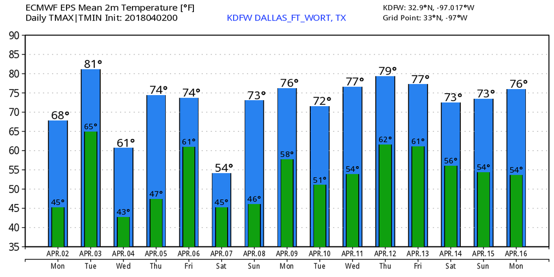 |
Archives
March 2023
Categories |
 RSS Feed
