
|
MILD MORNING: Temperatures are currently in the middle to upper 60s already this morning as the humidity is increasing. The sky will be mostly sunny, and highs will be in the middle 80s later this afternoon. The sky will continue to stay fair tonight, and we project a morning low in the mid to upper 60s again tonight. REST OF THE WEEK: The weather turns slightly warmer and more humid; look for highs in the mid 80s tomorrow and Friday. Some clouds will return on Friday with an approaching storm system, but rain chances will continue to be non-existent. ACROSS THE PLAINS: A very active pattern of severe weather is developing for parts of the Central and Southern Plains and the Mississippi River Valley region over the next 7 to 10 days. This marks the first time the SPC has a highlighted area of severe weather for all but one day with a 15% or greater probability of severe weather occuring. 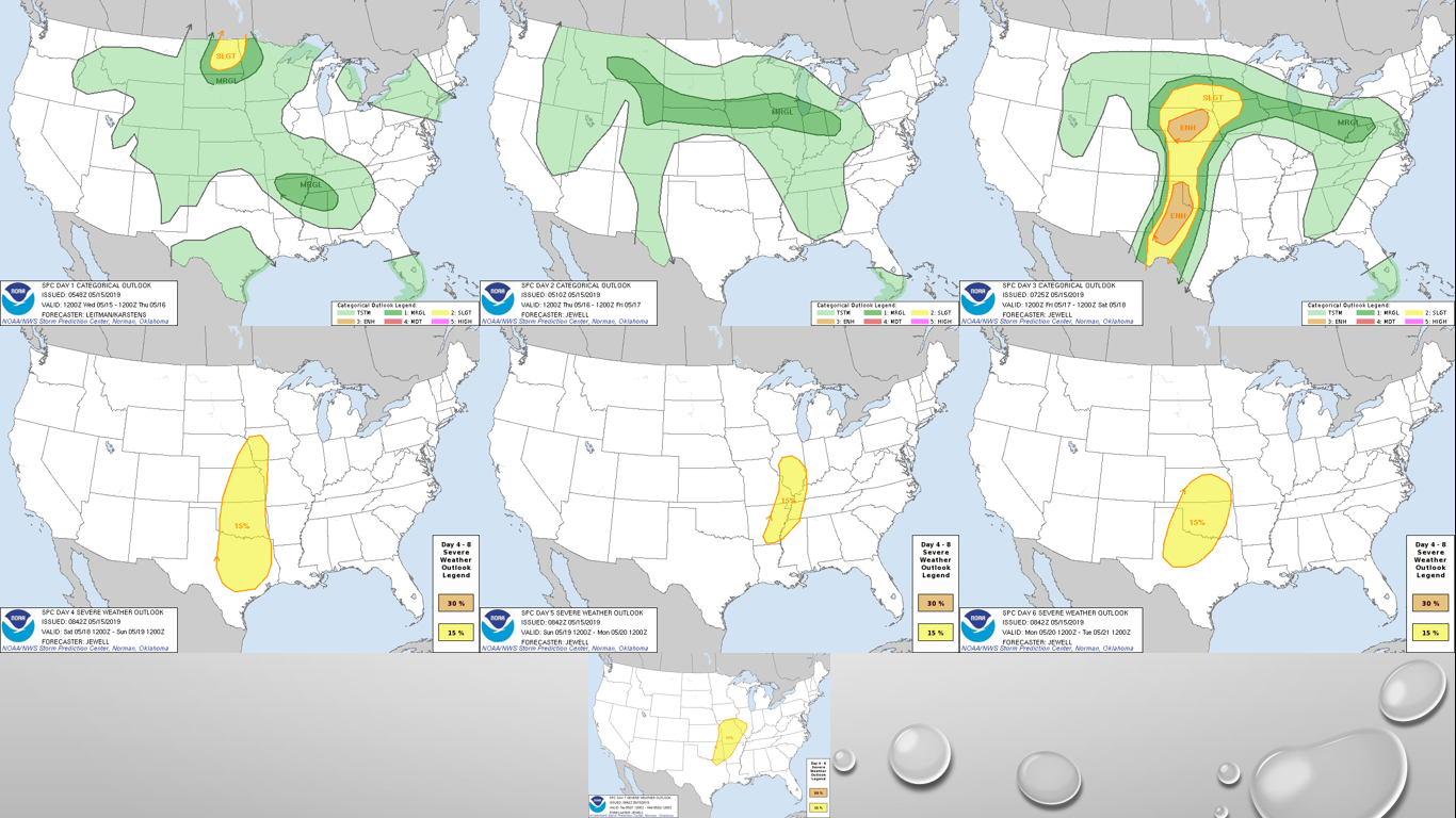 Our days to watch for North Texas is Saturday (Day Four) and Monday (Day Six). Saturday will feature more of a damaging wind event, but a few tornadoes are still possible in the storms that are more supercellular. Tornadoes and damaging winds are possible on Monday. The damaging wind threat will increase throughout Monday evening as storms begin to congeal and move to the east. The exact timing and placement of the storms are unknown at this time, as these events are still far too early to pinpoint specifics. Just know that everyday, somewhere will see severe weather for at least the next week. NEXT WEEK: After some severe weather on Monday leading into parts of Tuesday, expect some severe clear for the rest of the week with afternoon highs well in the mid to upper 80s for the latter half of the week. See the Texas Weather Discussion Video for more details. 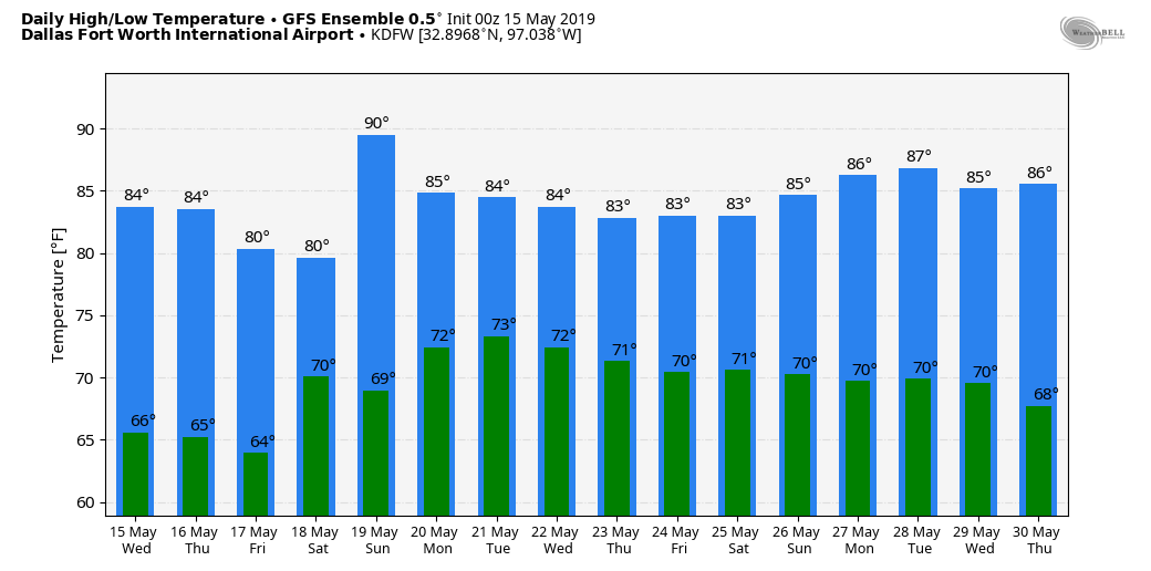 ON THIS DAY IN 1923: An early morning F5 tornado cut a 45 mile path of destruction through Howard and Mitchell counties. 23 people passed away and 250 were injured. The width of the tornado reached 1.5 miles at one point, and the entire farms were literally "wiped off the face of the Earth". The First Baptist Church in Colorado City became an emergency hospital for victims.
|
Archives
March 2023
Categories |
 RSS Feed
