
|
Air You Can Wear - Nearly everyone in North Texas starts the day dry with temperatures in the 60s, some in the upper 50s, which is a nice start to the first day of Meteorological Fall! We will most likely warm to the very low 90s today with plenty of sunshine and little to no precipitation chances, which is a great day for high school football. This evening, Mansfield High School will take on Summit High School at Vernon Newsom Stadium. Kickoff begins at around 7:30. By that time, the sun should be going down with highs remaining between 84 and 87. Labor Day Weekend - Things should continue to be nice and pleasant with highs in the low 90s with sunshine in full force on Saturday. During the overnight hours between Saturday and Sunday, moisture values will begin to increase, as well as the chance of scattered showers and storms during the night. A few spotty showers will still be possible during the day on Sunday. The best chance of one spot getting wet is in the 20-40 percent range. Most areas in North Texas will continue to stay dry this Labor Day weekend. Next Week - By Tuesday and Wednesday, a cold front will continue to move south, which will create more chances for evening/overnight scattered showers and storms and will also drop the temperature down to the low 80s. After that, the rest of the week should be pleasant with sunshine back in full force on Thursday. 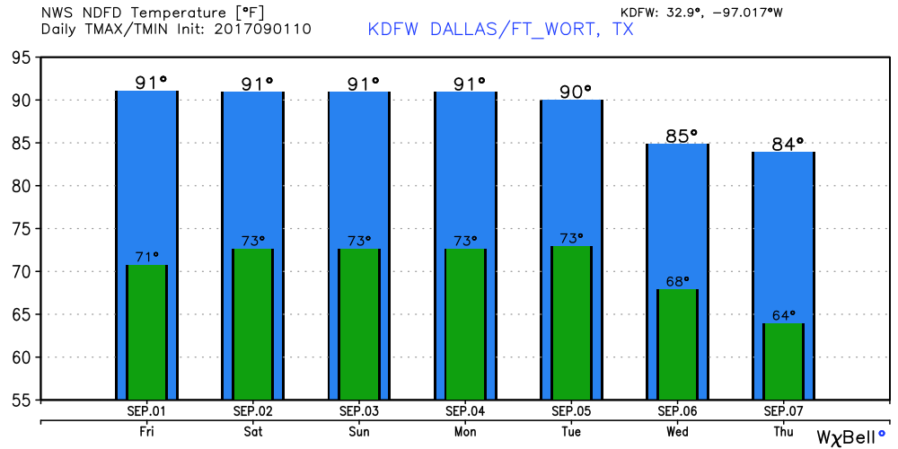 Harvey - Harvey is basically no more! The remnants of Harvey is in the southeast, but the main risk shifts from a flooding threat to more of an isolated tornado risk. Harvey should become post-tropical cyclone by this weekend. Irma - Within the past 24 hours, Harvey has gone from a tropical storm to a major hurricane. I will say that I have not seen that from a hurricane thus far. The GFS (Global Forecasting System) shows Irma coming very close to the East Coast. But the more reliable European model shows the hurricane affecting Cuba. The main point is that we currently do not know where this hurricane will go, and we won't know that for the next 4-5 days. 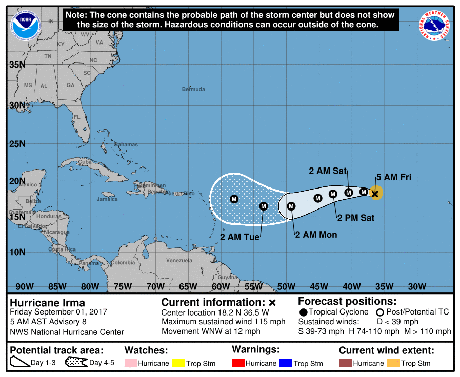 There is another wave emerging from the African coast that has a 50/50 chance of developing during the next five days. It is too early to tell the intensity of this disturbance, or where it will go, but if it becomes a tropical storm, its name will be 'Jose'. See the Texas Weather Discussion Video for more details. 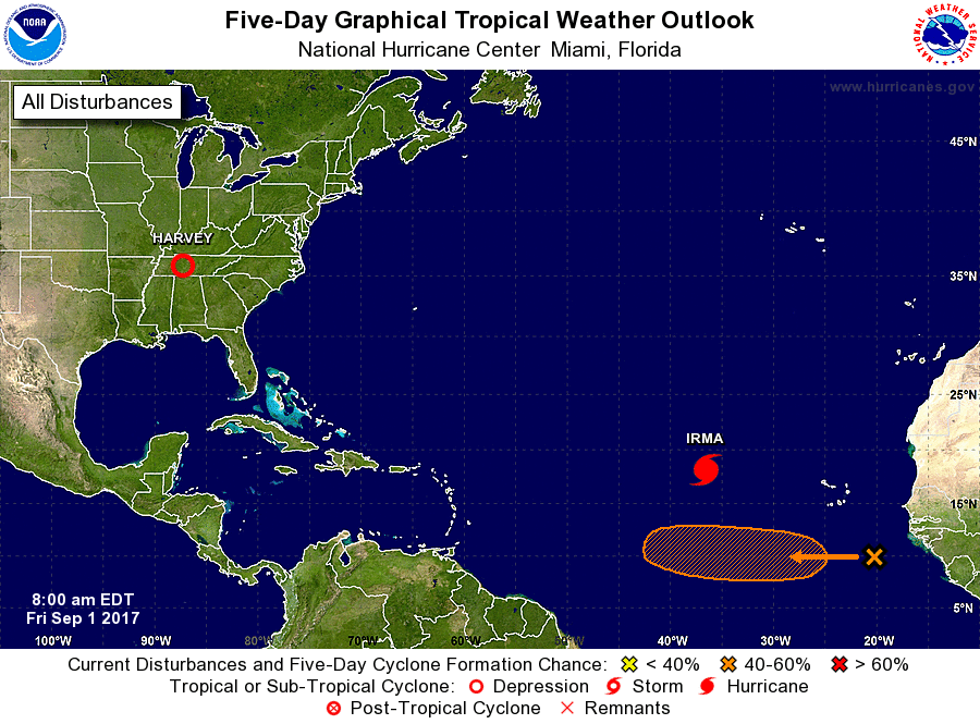 |
Archives
March 2023
Categories |
 RSS Feed
