
|
CHILLY START - Temperatures are mostly in the 40s across the metroplex, which is actually a few degrees above our average high of 40 degrees for December 3. A cold front comes through later today, so we won't warm much during the afternoon; we only project a high of around 50 degrees during the afternoon. The sky will mostly feature a mix of sun and clouds. We start tomorrow morning below freezing with overnight lows in the 30s. After a very cold morning, we are still cold by the afternoon with highs only in the mid 40s with mostly sunny skies. The good news is, the winds will not be strong, so it will not be a blistering cold. MIDWEEK - Not much change. Each day will feature a mix of sun and clouds with highs in the low to mid 50s by the afternoon. Overnight lows will be at the freezing mark on Wednesday, and in the low 40s by Thursday. I wouldn't be surprised if we could squeeze a couple of showers out by the afternoon hours. FRIDAY AND THE WEEKEND - A very potent storm system moves into the south-central plains from the Pacific, and that will be our next chance of widespread showers and thunderstorms statewide. The good news is, we are not expecting any severe weather at time, and rain amounts will mostly be in the 2-2 1/2 inch range. That same storm system will also be a catalyst for some "winter mischief" for parts of the Texas Panhandle and Oklahoma. However, global models have been trending this feature further south, getting close to some parts of North Texas. If we can get the colder air into the region faster than what the global model output is showing, we might have an increased chance of "winter mischief" of some sort for parts of North Texas. However, we do NOT expect any of that to happen at the present time; we will only mention the chance of widespread cold rain Friday with highs only reaching the low to mid 40s both Friday and Saturday. We will get a real look on how this storm system will behave by the middle of the week. If we don't see anything for the weekend, both days look mostly raw, cold days with highs struggling to get out of the low 40s with overnight lows in the low 30s to upper 20s. NEXT WEEK - Next week becomes gradually warmer with Monday still chilly, but gradually getting warmer towards the latter half of the week. Each day will feature a mix of sun and clouds. See the Texas Weather Discussion Video for more details. 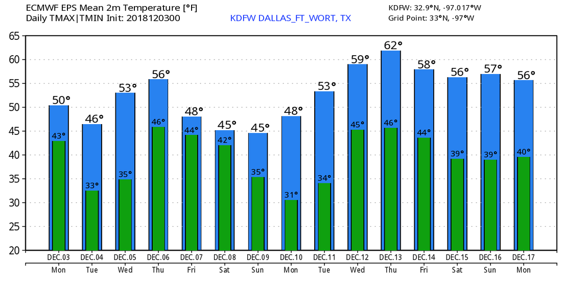 |
Archives
March 2023
Categories |
 RSS Feed
