
|
RADAR CHECK - Widespread showers and thunderstorms continue to move to the northeast this morning, affecting most of the North Texas area...  There will indeed be breaks in the rain from time to time, but expect numerous showers and thunderstorms all throughout the day as moisture continues to move to the northeast. Heavy rain will continue to come in waves throughout the day, and a Flash Flood Watch remains in effect for much of North Texas until tomorrow morning. 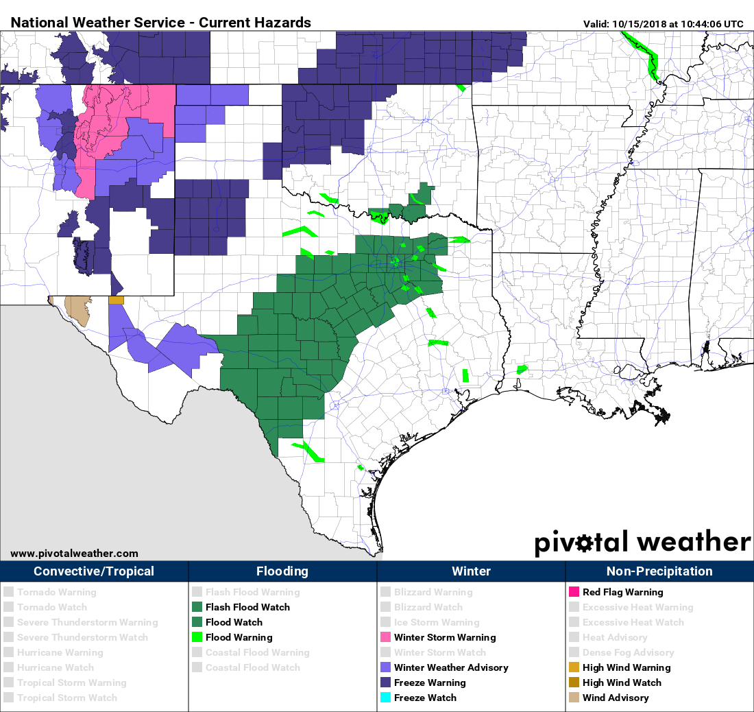 SWEATER WEATHER - Due to the cold front that came through overnight, we are currently seeing temperatures in the low 40s this morning, even as low as the upper 30s in some communities. DFW is tying its record low for the day of 42 degrees. We won't warm much today and tomorrow; we will only see temperatures as high as the mid 40s at best. The wind chill will feel like the middle to upper 30s in most spots, just at or above the freezing mark. WEDNESDAY THROUGH FRIDAY - Showers and thunderstorms begin to taper off during the morning hours on Wednesday, and we might see more breaks from the rain during the latter half of the week. But expect conditions to stay mostly wet throughout the work week with highs in the upper 50s/low 60s through Friday with mostly cloudy skies. THE WEEKEND - Rain finally begins to taper off Saturday afternoon as an upper high pushes a surge of drier air to the south. Expect a few scattered showers Saturday morning followed by dry conditions as we head into the afternoon and Sunday. We stay mostly cloudy with highs in the middle 60s throughout the weekend. NEXT WEEK - The early part of next week looks fairly dry to start off. Some rain could sneak into the latter half of the week, but we are still quite a ways away from that. Expect a mix of sun and clouds with highs in the middle 60s throughout the week. See the Texas Weather Discussion Video for more details. 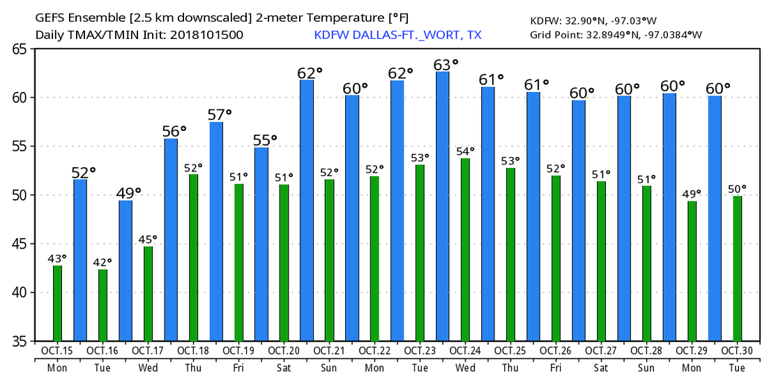 TROPICS - There is a small wave in the northern Caribbean that the NHC gives a 30 percent chance of becoming a tropical cyclone. It is expected to move onto land and weaken within the coming days. The rest of the Atlantic Basin remains quiet.
|
Archives
March 2023
Categories |
 RSS Feed
