
|
TYPICAL SUMMER MORNING: Temperatures are currently in the upper 70s to low 80s around the metroplex, which is pretty average for this time of the year. A rare summer time cold front will arrive in North Texas this afternoon, which may bring the chance of isolated showers and storms, especially for our southernmost counties. We will not experience cooler temperatures until the next day, and afternoon highs will be around the 95° range. TUESDAY AND THE REST OF THE WEEK: We will forecast highs in the upper 80s for Tuesday and probably Wednesday as well, which is ten degrees below our average high for this time of the year. Lower humidity values are also likely with mostly sunny skies. Highs will be close to the mid 90s by Friday. THE WEEKEND: Not much change. Each day will feature highs in the mid 90s with mostly sunny skies with a southerly wind. We continue to stay dry for the weekend. NEXT WEEK: We will forecast average summertime weather with mostly sunny skies. Highs will be in the mid to upper 90s again with dry conditions. No signs of any changes in the pattern for the foreseeable future. See the Texas Weather Discussion Video for more details. 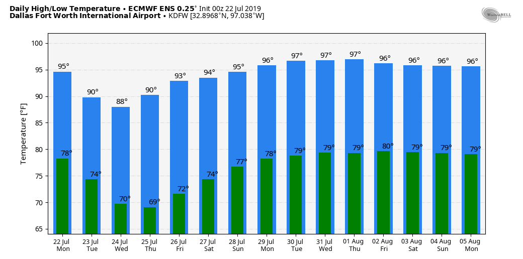 TROPICS: A disturbance in the Bahamas has a small chance of developing within the next five days. However, models currently point that the disturbance will curve to the North Atlantic, staying far away from land. The rest of the Atlantic Basin remains quiet. 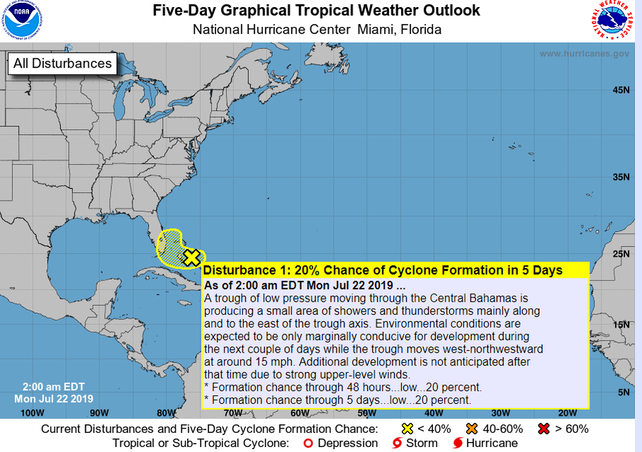 |
Archives
March 2023
Categories |
 RSS Feed
