
|
This morning - Temperatures have not changed much since yesterday morning; Arlington at 60 while DFW reports a temperature of 67. Don't get too caught up with these warm temps. A cold front will come through this morning, which will cause temperatures to go the wrong way as we progress through the day. Thankfully, it won't turn terribly cold like it has in the past almost every time it happens. We should fall to the low 50s this afternoon. Rain will become possible after 1:00P, with the highest coverage generally in our northern counties. It won't be a downpour, and rain amounts should stay below 1/4ths of an inch. We will see most of our rain come tomorrow morning. Prepare for a wet commute back home from work and school. The Weekend - After some showers pass through the area Friday evening, rain becomes widespread during the pre-dawn hours on Saturday, ending during the afternoon. Though, a few showers may still carry on during the afternoon. In terms of timing, the best chance for rain in North Texas will start before 2AM, then completely drying out by 10-11AM. Rain amounts should be in the 1-1 1/2 inch range, and severe weather should not be an issue. In fact, we probably won't see much thunder from this one either. We trend drier on Sunday, though we still could see a few showers pass by during the morning hours, but the rest of the day stays generally dry. We should be in the mid 60s by Sunday, and clouds will still stick to us throughout the day. Next Week and Beyond - We won't see much sun next week as the upper air pattern persists. Trough in the northwest, ridging in the Gulf of Mexico will create a broad southwest flow aloft, which will allow some rain chances almost everyday. 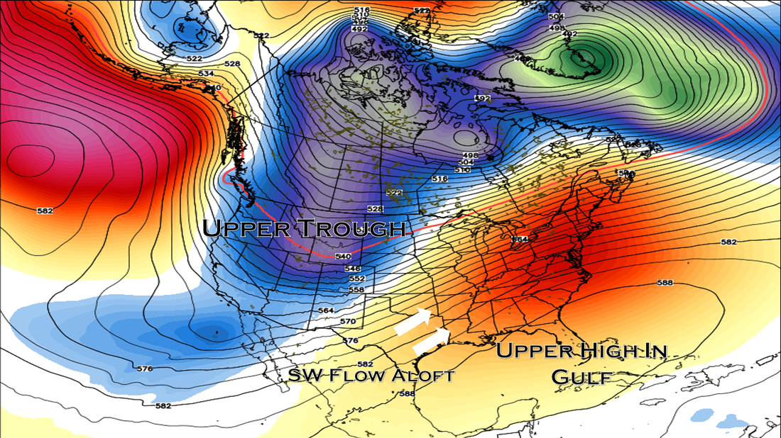 Temperatures will be in the 60s for the latter half of the week. 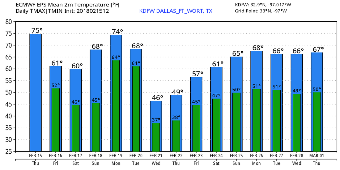 A Word of Advice - Winter is far from over, and cold snaps can still happen in March and April. The European Ensemble model shows one in mid March. See the Texas Weather Discussion Video for more details. 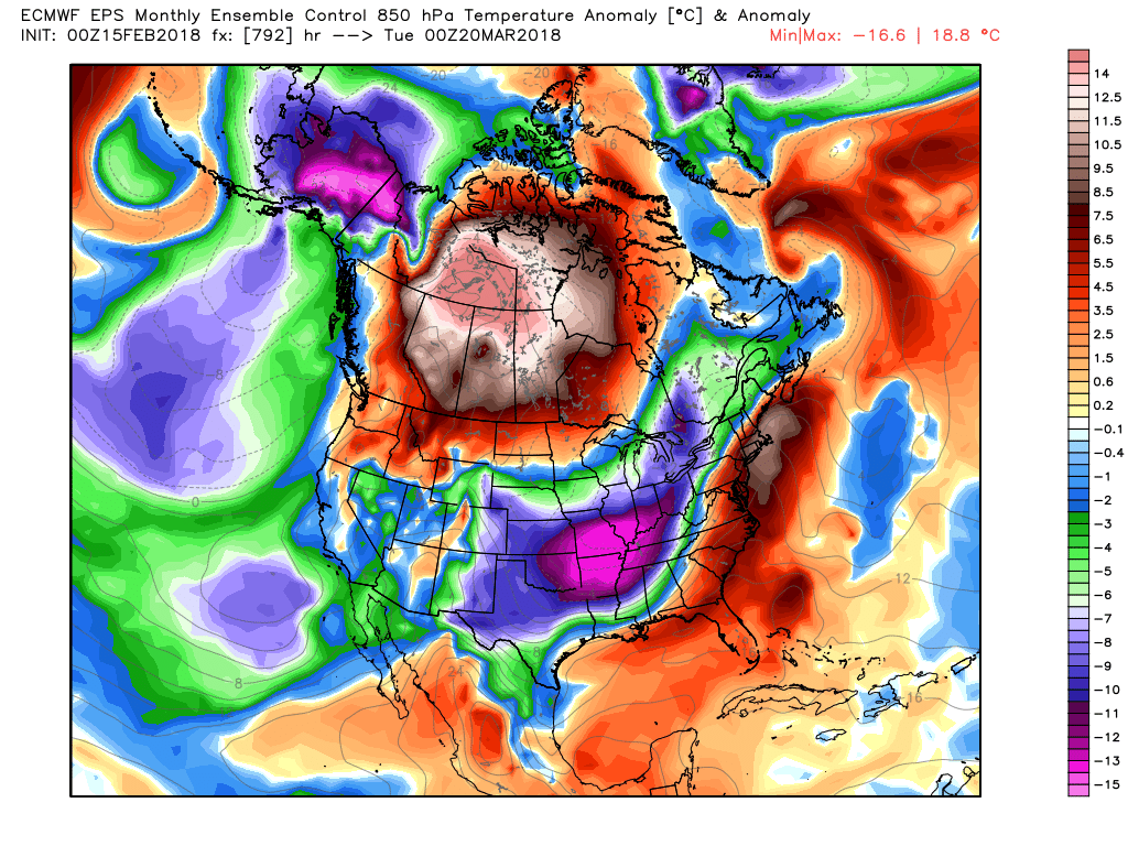 |
Archives
March 2023
Categories |
 RSS Feed
