
|
Radar Update - Scattered showers and storms have formed over North-Central Texas early this afternoon. If not stationary, slowly moving to the south, producing brief downpours and occasional lightning. 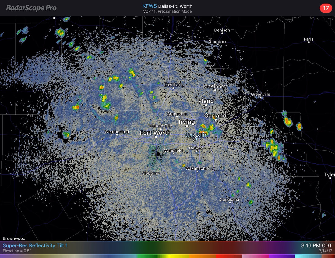 Any storms that are left should dissipate during the evening hours. Aside from the storms, most locations are already in the mid to upper 90s in the afternoon with a mix of sun and clouds. Weekend - There will be a risk for scattered showers and thunderstorms during the afternoon/evening hours each day of the weekend as a cold front drops into our area from the north. Due to the scattered nature of these storms, please note that not all locations will see rain. In fact, most won't see anything at all during the weekend. I'd say the chances of one spot getting wet is in the 30-35 percent category. By no means this will be a weekend washout. Other than, we will stick with the typical mid-July forecast; Mostly sunny and hot with highs in the mid to upper 90s. Next Week - As the upper ridge in the south builds, heights will start to come up around North Texas, which means that things will be drier and feel a little hotter as we get close to the peak of the summer in North Texas. Leftover moisture should still linger around Monday and Tuesday, so we mention still hold a chance for isolated showers and storms.The chance of any one spot getting wet will be in the 20% category. With drier and warmer air aloft, the chances will not be as great as in the weekend. Past that, temperatures should stay in the mid to upper 90s, average temperatures for mid July. See the Texas Weather Outlook for more details. 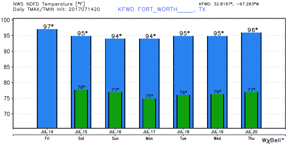 Tropical Talk - If you're heading out in the Atlantic, you're in luck! No activity in the form of tropical cyclones is expected for the next week. Remember, the peak of hurricane season is usually in August and September. 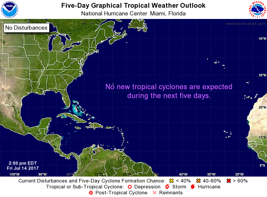 Have a great rest of the day!
Donovan Neal |
Archives
March 2023
Categories |
 RSS Feed
