
|
Cool Morning - Temperatures are generally in the 50s with light and variable winds this morning, enough for a light jacket as you head out the door. We project a high of just at or above 80 degrees this afternoon with a full supply of sunshine. Tonight will be warmer, with many places only falling to the low to mid 60s. Tomorrow and the Weekend - Tomorrow will be mostly dry, though we could mention the chance of a few spotty showers during the afternoon hours, but most places will stay dry. With a mix of sun and clouds, highs should be in the mid 80s. Then on Sunday, we turn dry with partly cloudy skies. Highs should be in the mid 80s. A surface boundary will stall somewhere along the Red River vicinity on Sunday, and we will need mention the chance of showers and thunderstorms during the evening. Based on instability values, severe weather appears possible, with large hail the prominent threat due to steep mid-level lapse rates. Keep in mind that it won't be a washout this weekend, and our greater chances of rain comes next week. Highs should be in the mid 80s on Sunday. Next Week - Our unsettled weather pattern begins next week, and we will mention a chance of showers and thunderstorms everyday through Thursday. We do note that the SPC introduces a risk of severe weather from around Del Rio, Texas to Hennessey, Oklahoma.  Our upper pattern will feature a trough in the southwest and ridging in the Gulf. This will set the stage for moisture to surge in from the Gulf and Pacific, and we will need to mention the chance of scattered to numerous showers and storms, especially towards the latter half of the week. We will fall to low to mid 70s for most of the week, and will overall look wet and muggy. See the Texas Weather Discussion Video for more details. 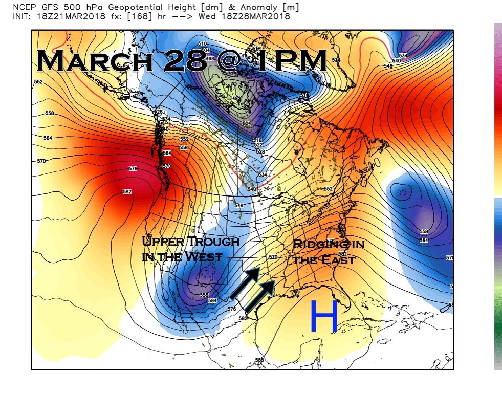 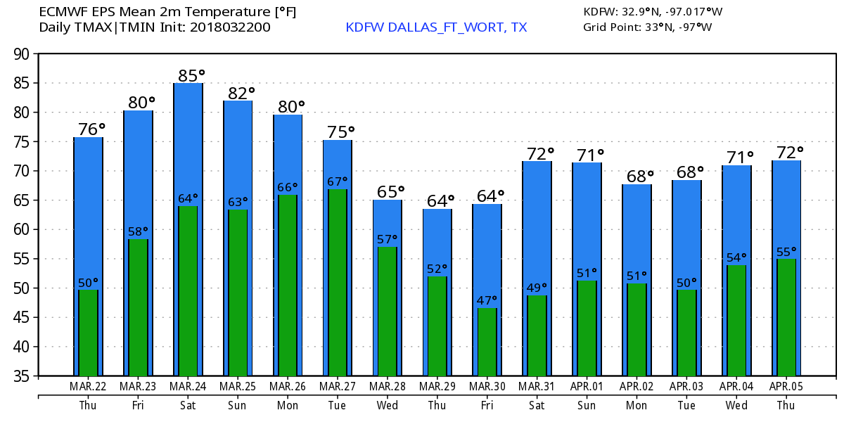 |
Archives
March 2023
Categories |
 RSS Feed
