
|
Radar Update - As most of our time, I start out this post by mentioning our usual batch of showers and storms this morning, to the north and west of DFW. 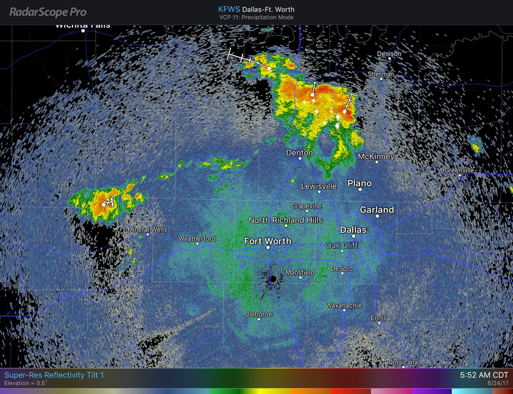 These storms are not severe, and are slowly moving to the north and east. Most locations in North Texas should stay dry this morning, with increasing rain chances this afternoon/evening. This afternoon/evening, due to increased moisture values, we could see scattered showers and storms mainly after 12 PM this afternoon. Due to the random nature of these storms, most locations in North Texas has a 50/50 chance of getting wet this afternoon. Severe weather is not expected, but some storms can produce some lightning and heavy rainfall which may lead to localized flooding. It should stay relatively cloudy for most of the day, with highs in the upper 80s. I expect rain chances to come down by Friday, but just know that we deal with isolated storm chances tomorrow morning as well. Most of the day should remain dry with good cloud coverage and highs in the upper 80s. The Weekend - As moisture levels almost stay the same, we continue to mention the chance for showers and storms for the weekend. These storms are most likely going to be scattered in nature due to moisture levels in association of Tropical Storm Harvey. At this point, our weekend weather will be mostly dependent on how Tropical Storm Harvey behaves, which there is a lot of uncertainty regarding that right now. I do think much of north Texas does have a chance of scattered showers and storms for much of this weekend, but Harvey could make it this week, or later in the week. Model agreement is not too compliant in this case, and will still mention a chance of scattered showers and storms this weekend. 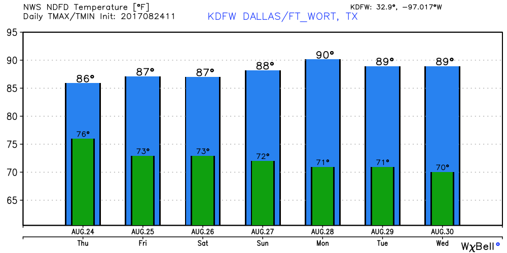 Harvey Expected to Become a Hurricane - The tropical storm in the western part of the Gulf of Mexico is expected to become a hurricane tomorrow afternoon before it makes landfall. Hurricane warnings have already been issued for all of the Middle Texas Coast, and should maintain its strength right at landfall. Hurricane or not, the main issue on the board is heavy rain for this region. Rain amounts of 1-2 feet is likely in southeast Texas, which includes but not limited to Houston and Galveston. This could lead to a significant, and life threatening flooding event. The GFS hints that this could drop 3-4 feet of rain as Harvey stalls around Southeast Texas due to poor steering currents. 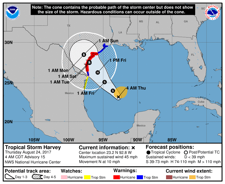 Invest 92L - There is another disturbance in the Florida Peninsula that is bringing heavy rain to the region right now. Slow development of this system is possible this weekend and early next week as it moves northeast back into the Atlantic. If a tropical storm forms, it's name would be "Irma". This will not be a threat to Texas or the Gulf.
See the Texas Weather Discussion Video for more details. |
Archives
March 2023
Categories |
 RSS Feed
