
|
CHILLY START - Temperatures are in the mid 40s across North Texas this morning, that's about ten degrees below the average temperature for early April. Not as cold as this weekend, but definitely weather to warrant wearing a jacket for. Luckily, we won't stay cold all day, and temperatures will reach the low 70s during the afternoon. The average high for DFW on April 9th is 75 degrees. Tomorrow will be very similar to today; cool nights, pleasant days, highs in the low 70s, lows in the mid 40s with lots of sunshine during the day. WEDNESDAY THROUGH FRIDAY - We start a warming trend through Friday. We will still stay pleasant with afternoon highs in the low 80s by Wednesday. We turn very mild by Thursday with highs reaching the mid 80s, and mid to upper 80s by Friday. Storm chances also return by Friday afternoon with a cold front and a dryline for storms to initiate. Some could turn severe with the possibility of all hazards. The Storm Prediction Center has parts of East Texas and the lower Mississippi Valley under a risk of severe weather for day five (Friday). 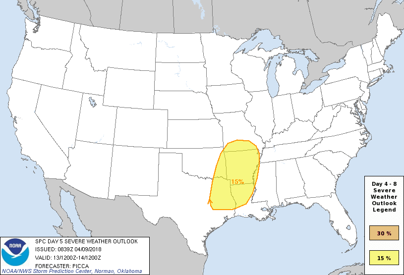 At this time, it is too early to specifically tell the placement of the dryline, and the possible hazard types. We will likely see the outlook chance within the coming days. THE WEEKEND - After the cold front moves through the area, cold air advection will follow, which means more cold air for the weekend. We won't see freezing temperatures like last weekend, but highs will struggle to get out of the 60s and 70s. Both days will feature a sunny sky with pleasant conditions. NEXT WEEK - The early part of next week looks pleasant and very dry. Most days will continue to feature sunny skies with afternoon highs in the low to mid 80s, just a little above average for mid April. See the Texas Weather Discussion Video for more details. 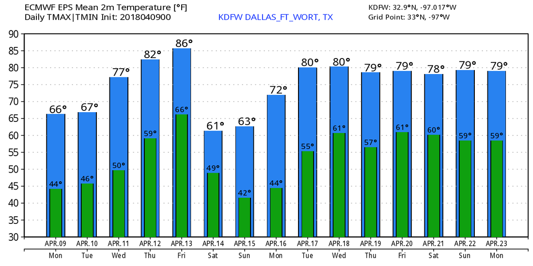 |
Archives
March 2023
Categories |
 RSS Feed
