
|
SUB-MOIST AIRMASS - This is about the time of year where moist unstable air is in place for much of the Deep South for late May through early September. As long as there is something to weaken the ridge in the southern plains, there's a good chance that at least some of that moisture could feed into Texas. But for the most part, most days usually stay dry and sunny in summer for Texas. Back on the moist airmass case, since we don't have it as bad as the Deep South, we will continue to mention a day mixed with sun and clouds with random isolated showers and thunderstorms. Any showers or storms should remain "few and far between". The heavier storms will produce lightning at times, so no threat of severe thunderstorms. Highs will mostly be in the low 90s with a mixture of sun and clouds. MEMORIAL DAY WEEKEND - Not much change. More sun than clouds, with rain chances diminishing during the weekend. However, we must keep an eye on the Gulf of Mexico for any tropical development as global models continue to suggest an area of low pressure. The European Model shows the center of the low near the Mississippi/Louisiana Coast Saturday afternoon, and it keeps it in the deep south through Monday. One way or another, this looks like better rain chances for the southeast, meaning that this will most likely not impact Texas. 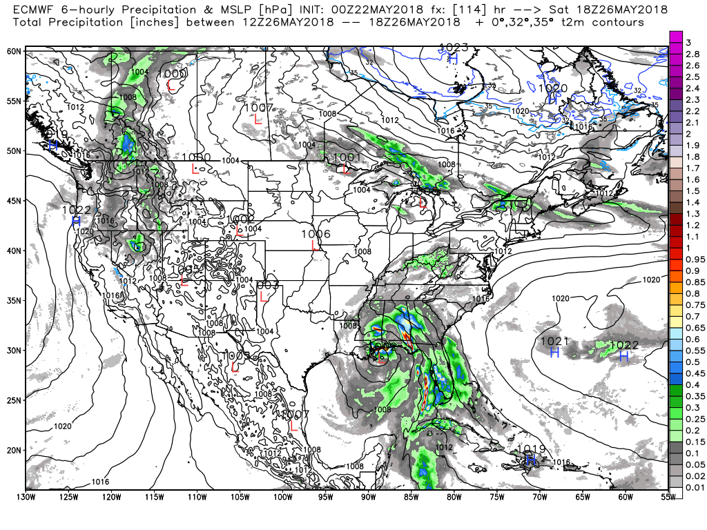 NEXT WEEK - Not much to suggest any change to the weather pattern next week. Ridging will still remain in place over the plains, meaning and showers and storms will be few and far between with more sun than clouds. Highs will be in the mid 90s. See the Texas Weather Discussion Video for more details. 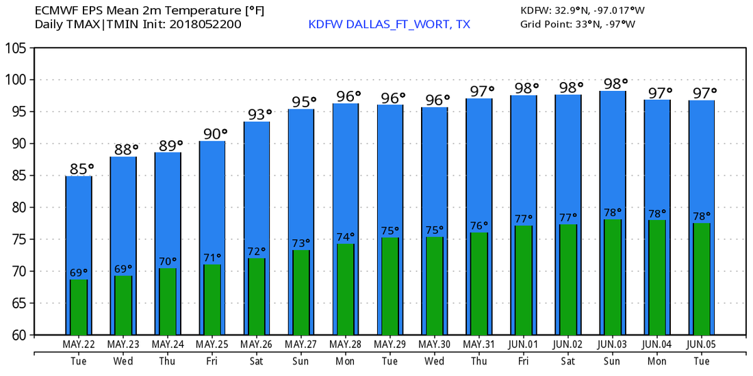 |
Archives
March 2023
Categories |
 RSS Feed
