
|
Here are some late afternoon temperatures across the DFW Metroplex... FW AIRPORT 93 DALLAS LOVE 94 FTW MEACHAM 92 DAL-EXECUTIVE 94 FTW-ALLIANCE 94 FTW-SPINKS 95 ARLINGTON 95 GRAND PRAIRIE 91 ADDISON 93 MESQUITE 93 LANCASTER 93 The average high for June 17 is 92°, so a number of communities around the metroplex are around or just above our seasonal average for this time of the year. The sky is mostly sunny, and storms to the east are few and far between. 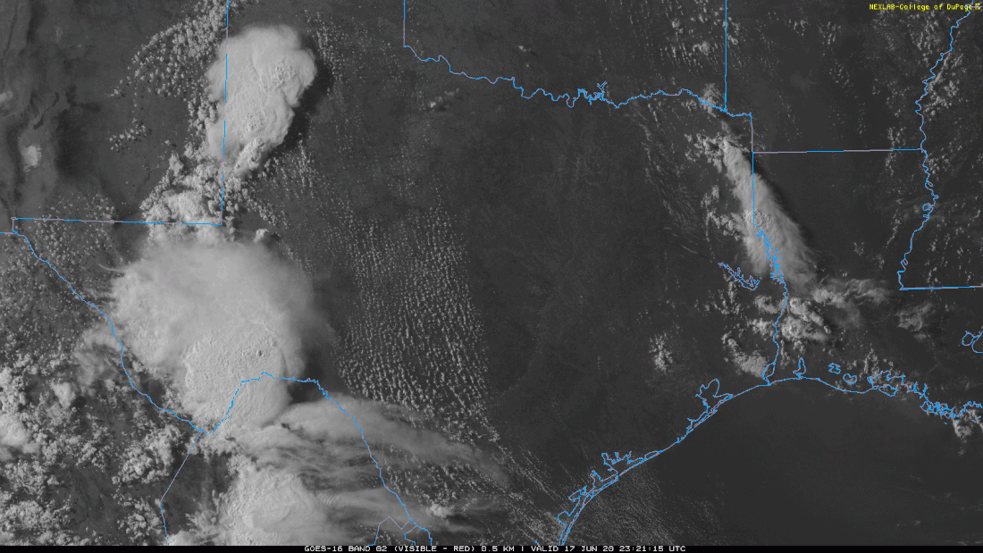 TOMORROW THROUGH THE WEEKEND: The weather will not change much tomorrow. Look for mostly sunny skies with a few widely isolated showers and storms, mainly for our eastern counties. The high will be in the low to mid 90s. Then, on Friday, a mesoscale convective system (MCS) could develop in Oklahoma, and make it to parts of the metroplex as it gradually weakens through the evening and overnight hours. Saturday will feature much of the same boring dry weather. Then, on Sunday, a mid June cold front makes its way to the area, which will subsequently raise our daily chances of scattered, mostly afternoon and evening showers and thunderstorms through at least the beginning of next week. There is a chance that a couple of storms on Sunday could be strong to severe during the peak of daytime heating. Temperatures will stay in the mid 90s with increased humidity. NEXT WEEK: Global models continue to hint the idea of increased coverage of scattered showers and thunderstorms each day as the air becomes more unstable, and the humidity continues to rise. Highs will be in the low to mid 90s with a mix of sun and clouds each day. 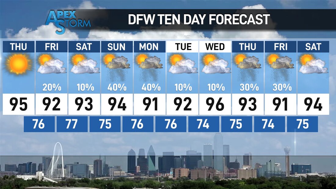 TROPICS: Dry, dusty air from the African deserts will move across the Atlantic in the coming days, eventually reaching the Southeast US by next week. This can set the stage for very vivid sun rises and sunsets, and it also means that no tropical storm formation is expected for the foreseeable future. The peak months of the Atlantic Hurricane Season is usually in August and September. The next named storm will be "Dolly".
ON THIS DAY IN 1882: A tornado traveled more than 200 miles across the state of Iowa killing 130 persons. The tornado traveled at nearly 60 mph and touched down about 90 miles west of Grinnell, struck the town and college around sunset, killing 60, and caused more than half a million dollars damage. |
Archives
March 2023
Categories |
 RSS Feed
