
|
MORE SUMMER WEATHER: A deep layer of moisture remains over North Texas today, which will result in higher temperatures and higher humidity values, resulting in Heat Advisory conditions. Afternoon highs will be in the triple digits again today with heat indices in the 105-110° range. This will likely be the last day of heat advisory conditions for a long time, if not, the year. TOMORROW AND WEDNESDAY: Our weather turns unsettled with a surface front moving through our area tomorrow, which will spark chances of scattered showers and thunderstorms across the region. Keep in mind that it won't be an all day type rain, just rain at times. There are possibilities for a few stronger storms in the mix with moist air and adequate dynamic support. The SPC has all of North Texas in a "marginal" (level 1 of 5) risk of severe storms tomorrow afternoon to address the potential for gusty winds associated with storms or a few wet microbursts. 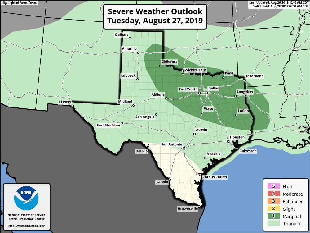 We do not expect any major flooding issues, as rain amounts will range from 1-3 inches in most spots. Some street flooding is possible with the most intense cells, however. There is a good chance that many communities hold in the upper 80s tomorrow because of clouds and rain, although some may reach the low 90s by the afternoon. The weather remains unsettled on Wednesday with showers and storms in the morning. Look for mostly cloudy skies with highs holding in the upper 80s due to clouds and rain once again. THURSDAY THROUGH LABOR DAY WEEKEND: A few storms are still possible through Thursday. Otherwise, we stay dry for most of the region this weekend with mostly sunny skies. Highs will range from 90-96°. The average high for DFW around this time of the year is 95°; we do not expect any excessively hot weather for the weekend. NEXT WEEK: Our first week of Meteorological Fall looks very pleasant with partly sunny days and temperatures just a few degrees below average. Fairly routine weather for early September begins with highs around 90-93°. See the Texas Weather Discussion Video for more details. 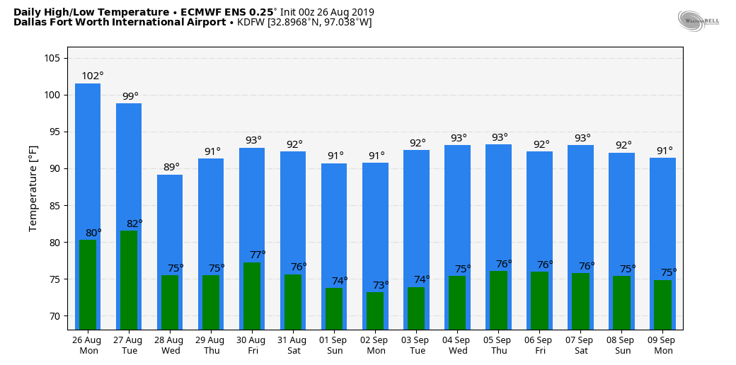 TROPICS: Invest 98L, which is located hundreds of miles to the east of the South Carolina coast, still maintains a high chance of becoming a tropical/sub-tropical storm within the next 24 hours. It will move to the northeast, away from the US. Further south, Tropical Storm Dorian in the Atlantic now has max. sustained winds of 60 mph, and will pass through the Leeward Islands early tomorrow morning. Any intensification will be delayed because of dry air around the system, but the NHC does have Dorian on track to becoming a category one hurricane as it nears the Dominican on Thursday. There is a chance that the mountainous islands and dry air destroys the system before it can move any further northwest, but the NHC moves Dorian through the Bahamas as a tropical depression Friday and the weekend. 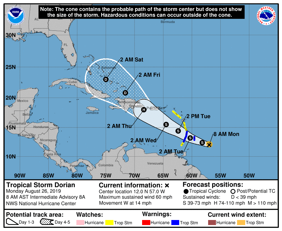 The truth is, it is still too early to determine what impacts the system might have on the US. However, the upper air pattern favors curving the system into the westerlies around the South Atlantic Coast. It will remain far away from the Gulf of Mexico if this happens, but still way too early to determine that. The rest of the Atlantic Basin stays quiet.
|
Archives
March 2023
Categories |
 RSS Feed
