
|
HOT AGAIN TODAY: Look for a high around 90° this afternoon with a mostly sunny sky; any scattered showers and storms later today will be over the southern half of the state. Isolated storms are still possible across southern parts of North Texas, however. The SPC has a "marginal risk" of severe storms defined for the southeastern portions of the state. 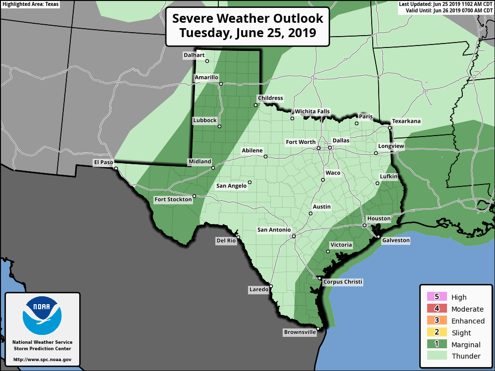 Where storms develop over that region they could produce gusty winds and hail. REST OF THE WEEK: Look for routine summer time weather for the region tomorrow through Friday with hot and humid weather with the rest of a few isolated showers and storms during the afternoon and evening hours. Mix of sun and clouds, fair nights, highs in the low 90s. THE WEEKEND: We will mention the risk of scattered, mostly afternoon showers and storms on Sunday between 12PM through 12AM. The chance of one spot getting wet is in the 20/30 range, and afternoon highs will be in the low 90s, typical Texas Weather for the end of June. NEXT WEEK: We will continue to stick with a consistent forecast for the Fourth of July week... mostly sunny, hot and humid days with "isolated, mostly afternoon showers and storms" everyday. Highs will continue to be in the low 90s. See the Texas Weather Discussion Video for more details.  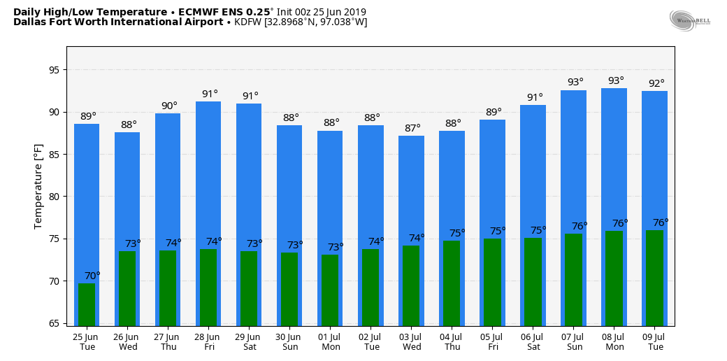 SAL: The Saharan African Dust has moved into parts of the Deep South and will move into parts of North Texas tomorrow evening. The highest concentration of dust will keep to the east. This is what is keeping our tropics quiet for June. 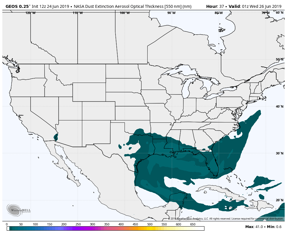 |
Archives
March 2023
Categories |
 RSS Feed
