
|
Radar Update - As expected, we have the typical case of morning showers to the north and west of DFW. They are moving to the northeast, and should not leave a huge mess when traveling to work and school. In fact, some rain is not even reaching the ground... 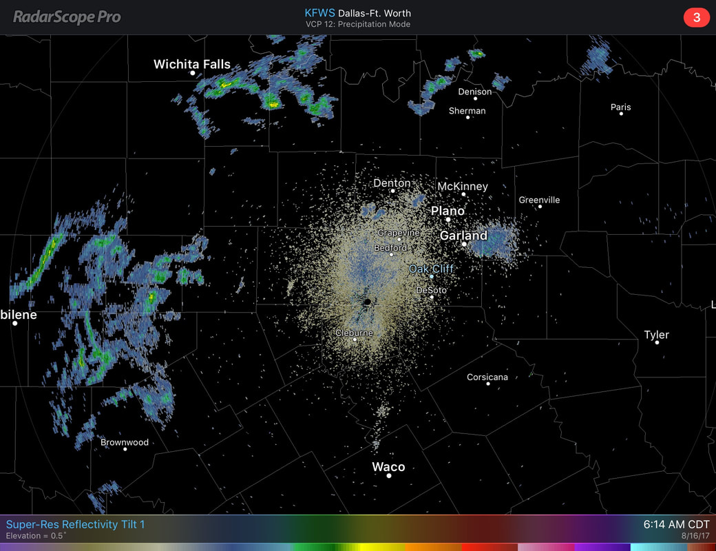 Otherwise, traveling to work and school, things should be quiet with cloudy conditions and highs in the low 80s, warming to the mid and upper 90s today. For the Rest of the Week - Not much change. A cold front tries to slide through tomorrow, bringing at least slightly better chances for showers and storms on Thursday. The best chance for any one spot getting wet is in the 20 to 30 percent range, mainly in the afternoon/evening hours. Otherwise, expect a mix of clouds and sun with highs in the mid to upper 90s again. The Weekend - Things should trend a little drier. Any showers and storms should be less in number, with sunshine back in full force with highs in the upper 90s at the Upper High makes its debut. Solar Eclipse Weather - A new post will be available later today to detail the weather forecast, and much more about the eclipse. Tropics - Things are starting to get active. Hurricane Gert is past the outer banks of the Bermuda, moving northeast towards North Atlantic with maximum sustained winds at 90 mph, and should pose no threat to land. Invest 91L has a good chance of becoming Tropical Storm Harvey in the next few days. Models bring it towards the Caribbean, and into Central America, but does not look like it will be a threat to the Gulf of Mexico. Invest 92L is a higher latitude system that could develop as well. Models pass it due north of the Carribean, again, posing no threat to the Gulf of Mexico. There is another wave just off the coast of Africa that we will worry about with time. See the Texas Weather Discussion Video for more details. 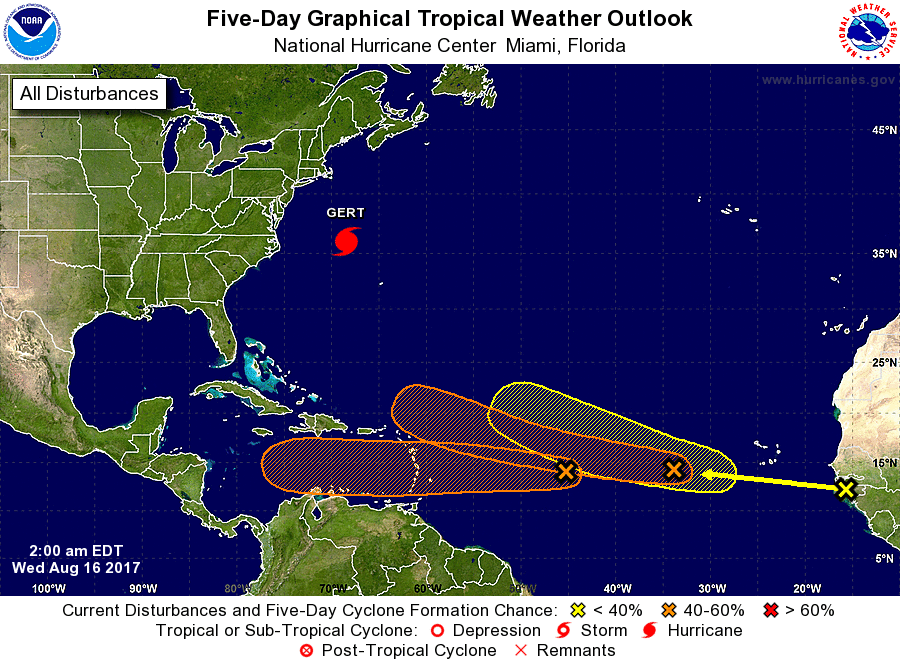 Look for the next forecast by me by 6:00 A.M. tomorrow morning.
Make it a great day! |
Archives
March 2023
Categories |
 RSS Feed
