
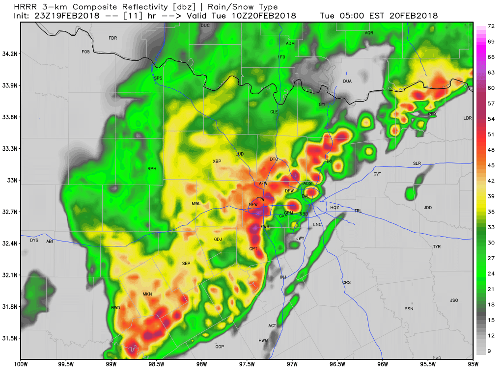
 ABOVE IS A RADAR SIMULATION FOR 4:00 AM CST.
Strong to severe thunderstorms will move in late tonight into daybreak tomorrow. These storms may contain quarter size hail and damaging winds, and an isolated tornado cannot be ruled out west of I/35. Instability looks quite impressive, especially considering that this is an overnight event, when we usually stabilize. Instability will be near 2,000 jKg overnight, which is very supportive for severe weather. The leading edge of this complex is the concern. Notice the purples along the leading edge? That's very heavy rain and hail. And notice how it's bowing out? That's a sign of a damaging wind threat. Here's one of my concerns: Discrete storms may develop just ahead of the main line. These will be capable of large hail, and possibly a low tornado risk. The storms may also dump 1-2" of rain across the DFW area. Some areas may see 3-4" which may aggravate flash flooding, mainly in those low-lying areas. But, this will not be a major severe weather outbreak, but several severe thunderstorms are possible along the leading edge. I am always available on social media on twitter @wx_dfw so feel free to message me and I will answer your questions. Also message @apex_dfw_wx and he will answer your questions as well. We are both here and will post as this line of storms approaches and will let you know of all watches and warnings that are issued by the National Weather Service™ in Fort Worth, Texas. -Jonathan |
AuthorWrite something about yourself. No need to be fancy, just an overview. Archives
March 2021
Categories |
 RSS Feed
