
|
The Storm Prediction Center has areas along and south of I-20 in North Texas under the standard Slight (category 2) risk for severe weather this afternoon and evening. For now, it looks like we will be dealing with all modes of severe weather, including the potential for a couple of tornadoes. 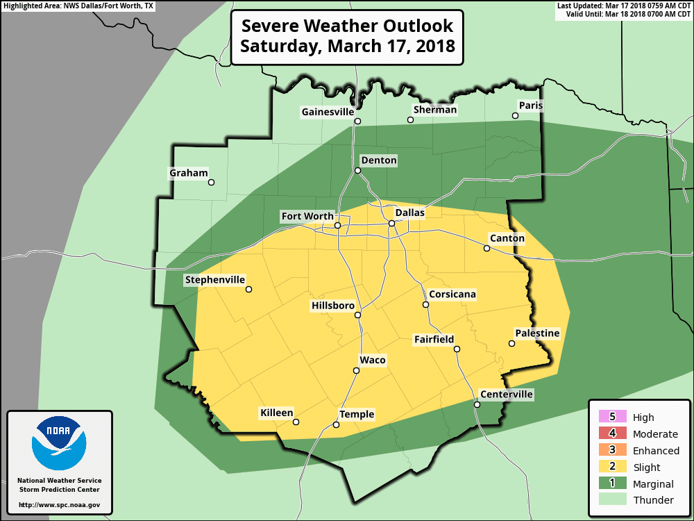 CURRENT CONDITIONS - It may feel dry now, but dewpoints are currently in the mid 60s as far north on a line from Hillsboro to around Tyler. As more moisture from the gulf surges northward, we will see these dewpoints increase throughout the day.  As we progress through the day, a cold front will slowly move in from the north, and stall somewhere along the I-20 corridor. Areas to the south of the stalled front will have the best chance of seeing thunderstorms as the moisture interacts with the cold front. Once we get into the afternoon hours and daytime heating starts to take effect, a surface low is expected to develop in west Texas near Abilene. While that is taking place, a dryline will establish itself to the south of the surface low. Storm initiation is expected to occur along and areas to the east of the dryline, more specifically around Coleman and Lake Brownwood, just to the southeast of Abilene. The best time for storm initiation is around 2 to 3 PM. Areas to the south of the cold front and to the east of the dryline will have the best chances of having severe storms. 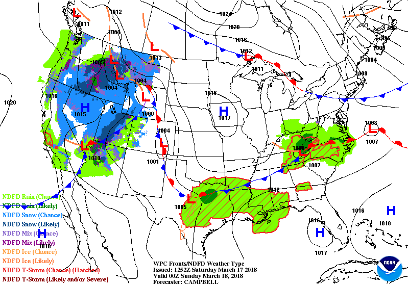 So how unstable will we be by the afternoon hours? - If we were to base this off of the High-Resolution Rapid Refresh Model (HRRR), the Most-Unstable CAPE values will likely exceed 2400 j/kg after 4PM. This is obviously sufficient for severe thunderstorm development, especially this early in the season. Moreover, steep low to mid level lapse rates will support the risk for large, and locally significant hail with the strongest storms. However, low level shear and hodograph sizes may be limited this evening, but shear vectors will still be in excess of over 50 knots. Therefore, some tornado potential may develop with the storms that remain discrete in nature, but will be very isolated. Storms will increase after initiation, and the activity will move to the east towards the Ark-La-Tex region.
Most of the day should be dry, but the bottom line is - I would not cancel your plans this afternoon. The most likely timing for storms to enter the DFW metro is 4 to 6PM. For now, all modes of severe weather is possible, but will remain very isolated. Be sure to check this page for updates throughout the day. Also, be sure to use our interactive radar on our website! |
AuthorWrite something about yourself. No need to be fancy, just an overview. Archives
March 2021
Categories |
 RSS Feed
