
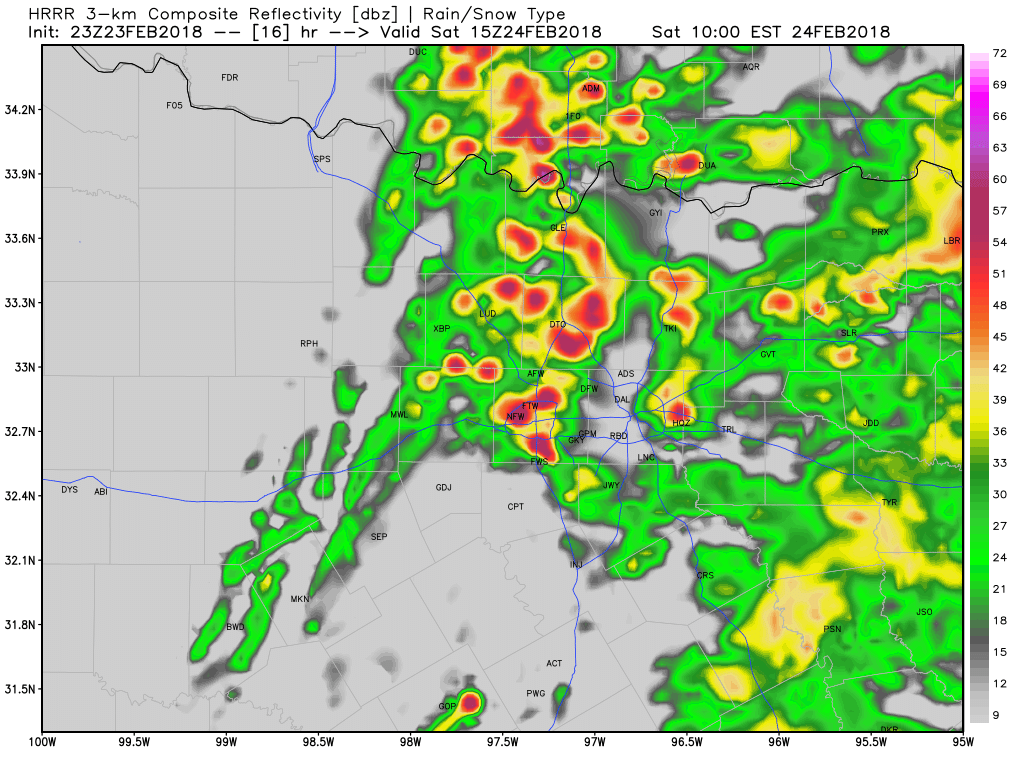
 SIMULATED RADAR FOR 9:00AM TOMORROWWidespread fog and heavy drizzle has developed across the entire Dallas/Fort Worth area, and a Dense Fog Advisory is in effect until 4:00AM tonight. A warm front is lifting north through the region as we speak, and temperatures are expected to rise for areas south of I/30. (Including the metroplex) As this front lifts north and we are in the warm sector, this is when I expect scattered thunderstorms to develop near daybreak tomorrow. Storms will move in from the south near 6-7AM, and these storms will have the potential to produce large hail and very heavy rainfall. Then as we head into the mid morning, things really begin to become interesting. A cold front/dryline combination will move into the region, with severe thunderstorms developing along these upper level features. An intense line of storms will develop in our western counties by 9AM, and this is when the DFW area will need to be on high alert. We will watch for any discrete supercellular storm development, and if these storms develop, we may have an enhanced tornado risk in the Dallas/Fort Worth metroplex. We will watch this closely. Late morning, this squall line of severe storms will move into DFW. Large hail, damaging winds, and embedded tornadoes are possible. A SEVERE THUNDERSTORM WATCH or a TORNADO WATCH will likely be issued tomorrow morning for the DFW metroplex. By afternoon, all storms will push into East Texas, and the severe threat will continue out there. Mainly cloudy skies will remain during the afternoon, but I think some sunshine is likely! Dry weather returns Sunday and Monday, with storm chances returning Tuesday and into Wednesday, with another potential of heavy rain and severe storms exists, especially on Wednesday. Dry weather is expected late next week. There is still no sign of wintery weather in the next 10 days, but as I've said, March may have a few periods of colder weather, so we will see if we can get some cold air back into North Texas with some snow to come with it! The updated seven day forecast will be uploaded to the website by 9:00pm tonight. Follow me on twitter @wx_dfw as I will be providing you will information and any warnings or watches issued in the Dallas/Fort Worth area tomorrow morning. -Jonathan |
AuthorWrite something about yourself. No need to be fancy, just an overview. Archives
March 2021
Categories |
 RSS Feed
